Beales Corner, Bewdley, Flood Risk Management Scheme
Overview
Page created February 2021. Last updated 20 May 2025
Tuesday, 20 May 2025:
This platform will be closing at the end of May 2025. We will continue to keep the community informed through alternative channels, including our mailing list, which you can join by emailing us at: BLBFRMS@environment-agency.gov.uk
Friday, 21 March 2025:
This platform may be closing at the end of March 2025. In preparation for this, and while we investigate other options, we will continue to collate our distribution list so that we can update interested parties periodically. If you are not already on the mailing list and would like to be added, please submit your name and email, referencing 'Beales Corner', to us at: BLBFRMS@environment-agency.gov.uk
*Project Updates*
End of Year Update - 23 December, 2024
Please see our end of year update on the Beales Corner, Bewdley Flood Risk Management Scheme.
8 November, 2024
Please see the 8 November 2024 update on the Beales Corner, Bewdley Flood Risk Management Scheme.
23 August, 2024
Please see the 23 August 2024 update on the Beales Corner, Bewdley Flood Risk Management Scheme.
28 June, 2024
Please see the 28 June 2024 update on the Beales Corner, Bewdley Flood Risk Management Scheme.
24 May, 2024
Please see the 24 May 2024 update on the Beales Corner, Bewdley Flood Risk Management Scheme.
17 May, 2024
Please see the 17 May 2024 update on the Beales Corner, Bewdley Flood Risk Management Scheme.
10 May, 2024
Please see the 10 May 2024 update on the Beales Corner, Bewdley Flood Risk Management Scheme.
3 May, 2024
Please see the 3 May 2024 update on the Beales Corner, Bewdley Flood Risk Management Scheme.
23 April, 2024
Please see the 23 April 2024 update on the Beales Corner, Bewdley Flood Risk Management Scheme.
12 April, 2024
Please see the 12 April 2024 update on the Beales Corner, Bewdley Flood Risk Management Scheme.
28 March, 2024
Please see the 28 March 2024 update on the Beales Corner, Bewdley Flood Risk Management Scheme.
22 March, 2024
Please click here for the 22 March 2024 update on the Beales Corner, Bewdley Flood Risk Management Scheme.
15 March, 2024
Please click here for the 15 March 2024 update on the Beales Corner, Bewdley Flood Risk Management Scheme.
8 March, 2024
Please click here for the 8 March 2024 update on the Beales Corner, Bewdley Flood Risk Management Scheme.
1 March, 2024
Please click here for the 1 March 2024 update on the Beales Corner, Bewdley Flood Risk Management Scheme.
23 February, 2024
Please click here for the 23 February 2024 update on the Beales Corner, Bewdley Flood Risk Management Scheme.
16 February, 2024
Please click here for the 16 February 2024 update on the Beales Corner, Bewdley Flood Risk Management Scheme.
19 December, 2023
Please click here for the latest newsletter on the Beales Corner, Bewdley Flood Risk Management Scheme.
Happy holidays!
Flooding in Beales Corner
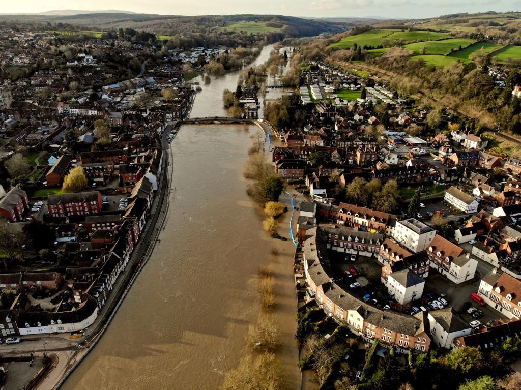
Bewdley is subject to significant flood risk from the River Severn and has flooded a number of times. The most significant flood events have been in 1947, 1965, 1998, 2000, 2002, 2004, 2008, 2014, 2020 and 2021. During the most recent events (2020, 2021 and 2022) some homes and businesses were flooded.
These flood events impact on people’s homes, businesses and the local economy. Transport links and commuter routes through the town are also affected.
Background to the flood risk management scheme
Over the years a number of technical assessments have taken place to explore the possibility of a flood defence scheme at Beales Corner in Bewdley.
Unfortunately a Flood Risk Management Scheme has not been viable previously. To date, measures, such as the temporary flood barriers and Property Level Resilience measures (e.g. flood gates, pumps and air brick covers for individual properties) have reduced the impact of flooding. However we recognise the limitations these solutions offer.
After the flooding in 2020, more funding was made available from Government for flood schemes nationally. This allowed us to re-look at options for a permanent Flood Risk Management Scheme for the area.
We are now developing a Flood Risk Management Scheme for the area. We are currently looking at options, carrying out ground investigations and talking with the community to help shape our thinking.
On the 27th of July 2021 Minister Pow visited Bewdley and we are delighted to say that during this visit it was announced that Government has allocated £6.2m of growth funding for the Bewdley Left Bank Flood Risk Management scheme.
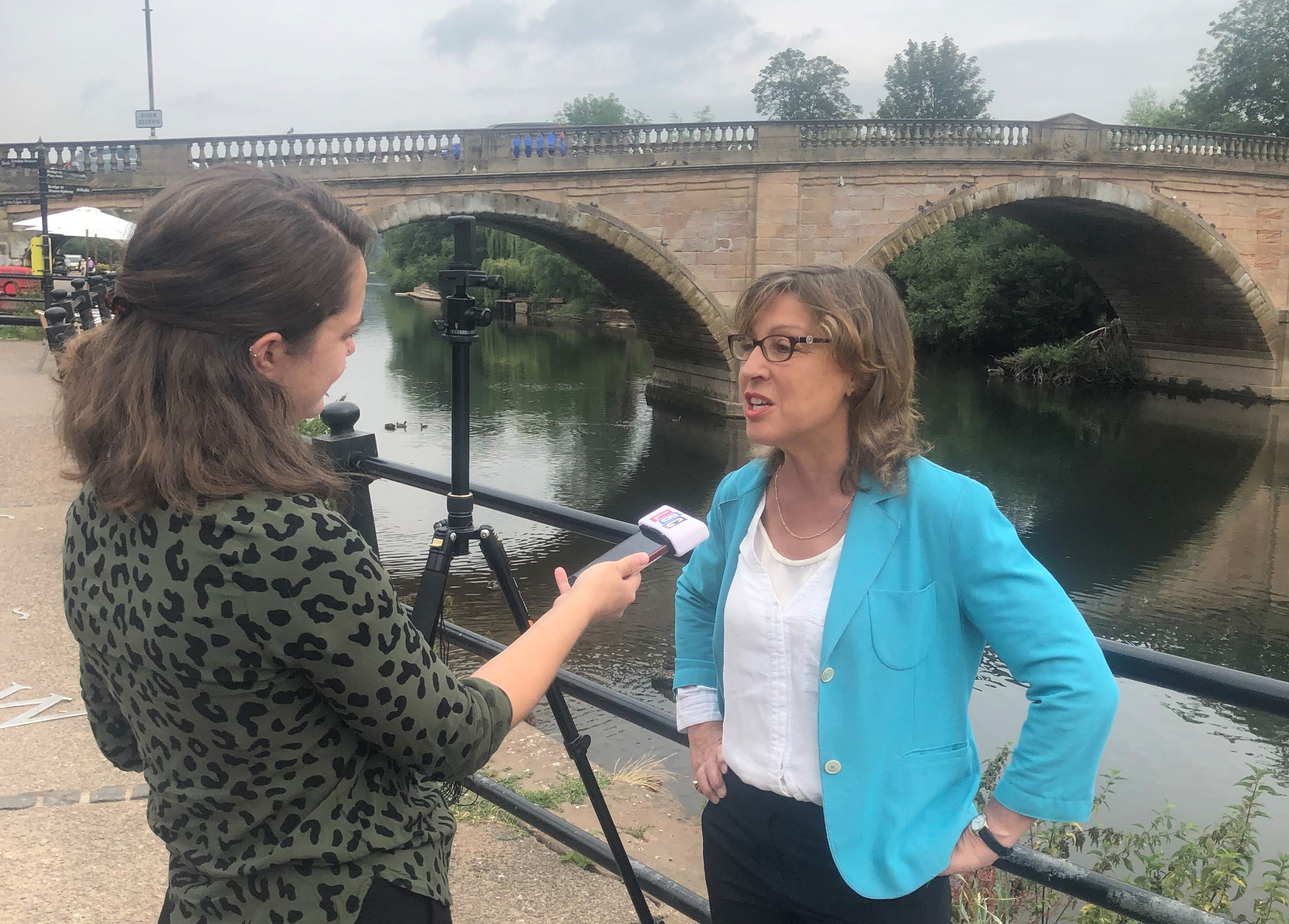
This made the possibility of a scheme more viable. There are still risks to delivery that the Project Team needs to work through, such as securing planning consent, all historic consents and managing the large number of utilities that are located along the potential alignment of any raised defence. However, the Environment Agency together with all partners are committed to driving forward the delivery of this project.
Proposed scheme details
We undertook a range of community engagement events from March to November 2022. We have noted the feedback from these events and we considered how we amend the design accordingly where possible. We plan to organise a further series of sessions in summer 2023.
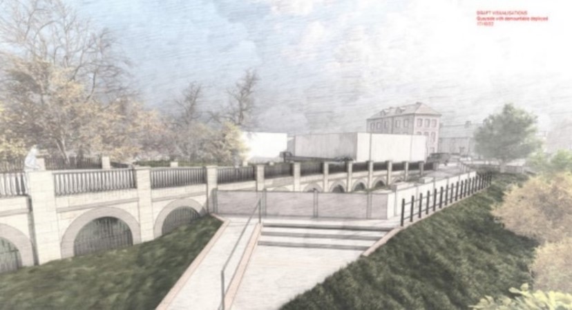
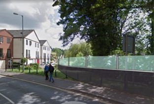
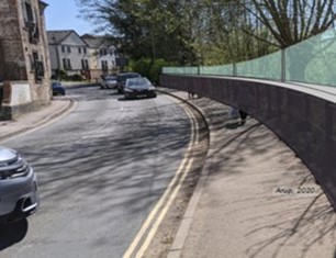
The team initially explored a long list of flood risk reduction options like attenuation and channel improvements as well as raised flood defence options. The final and most viable option consists of a combination of demountable flood barriers and permanent raised walls with glass panels on top to maintain views across the river.
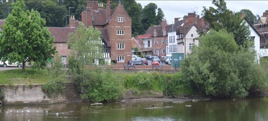
The photos below show the approximate alignment and extent of the proposed demountable defences by the Quayside and gives an artist impression of what the defences may look like on other sections of the scheme.
The design aims for this scheme are to:
- Reduce flood risk to people, properties, businesses, and highways resulting from overtopping of the River Severn
- Deliver a flood risk management scheme that is supported by the local community
- Integrate with and where possible enhance the natural environment, biodiversity and heritage value of the area
- Design and develop a scheme which has minimal operational and maintenance requirements
- Provide the same standard of protection as provided by the Severnside flood defence on the right bank.
- Ensure the bridge remains open during flooding, benefiting the entire community of Bewdley.
We aim to make best possible use of the public money available and seek to maximise funding available through working in partnership.
The primary purpose of the scheme is to reduce the flood risk from the River Severn. Although it is not focussed on flood risk from drainage issues, we are working with Severn Trent Water and the local authorities to review these.
Timescales – what we are doing and when
Over the coming months we will focus on:
- Development and approval of the Full Business Case
- Public Engagement in early summer 2023
- Aim to start utility diversions in summer 2023
- Anticipated start of construction in late summer/early autumn 2023
The public engagement meeting in early summer will focus on the construction phase of the scheme, outlining what the construction program is likely to be as well as the levels of disturbance to the town.
It is inevitable that there will be a need for temporary site and clearance works to allow the contractors to work safely. There is also likely to be road closures and traffic control. We want to use this session to talk through details of any disturbance during construction and can assure you that we will be keeping this as low as we can. This is all subject to having the Final Business Case approved.
Previous project updates
8 December 2023:
We are pleased to announce our intention to remove one-way traffic management restrictions on Kidderminster Road for the Christmas period.
Severn Trent Water and its contractors have completed work according to schedule, and Kidderminster Road will revert to two-way traffic from Friday 22 December for a temporary period.
Kidderminster Road will return to a one-way system from Tuesday 2 January to allow construction of the flood risk management scheme to continue.
Traffic restrictions will remain in place on Stourport Road.
We endeavour to remove any traffic restrictions where practicable, however, there may be some circumstances outside of our control which mean it is not possible to do so, for example, in periods of flooding.
We would like to thank the community of Bewdley for their continued patience and understanding during the construction of the flood risk management scheme.
Together with our partners, the Environment Agency is working now to protect Bewdley for the future.
29 September 2023
The project is progressing well, and we are approaching the time where we will need to implement the traffic management along Kidderminster Road and Bewdley Bridge. It has been agreed in conjunction with Worcestershire County Council that the traffic management will involve a one-way system where the traffic flows into Bewdley town Centre from Wribbenhall.
All roads will remain open both ways for pedestrians and cyclists.
Traffic management will commence from 19 October 2023 and will be in place through most of the construction period, which is anticipated to be between 18 and 22 months.
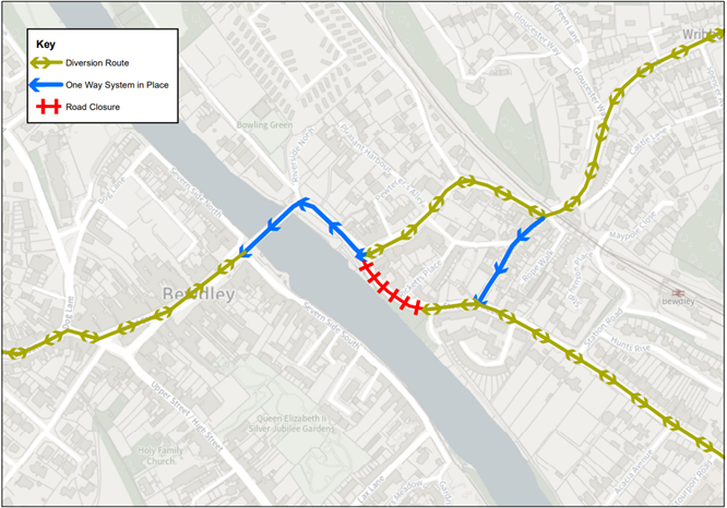
In line with the requirements of the Worcestershire County Council traffic order, there will also be a one-way system in place on Westbourne Street. This has been required by Worcestershire County Council due to concerns for public safety.
This one-way system will run from north to south from the junction with Kidderminster Road to the junction with Stourport Road and will also be implemented from 19 October.
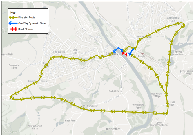 The current road closure on Stourport Road will remain in place until the completion of the works.
Worcestershire County Councillors have arranged a meeting to take feedback from residents and business owners, and to understand the views of the community on how the traffic management is working. The meeting is on 31 October 2023 at St Georges Hall, Bewdley, from 7pm – 9pm. The councillors would like the first hour to be focussed on the residents and the second hour to be focussed on traders.
Key Dates
|
Traffic Management Commences on Kidderminster Road and Westbourne Street |
19 October |
|
Meeting with Worcestershire County Councillors |
31 October |
24 August 2023
Thank you to everyone who was able to attend our public meeting on 17 August. For those of you who were unable to attend, or would like to view the presentation that was shared on the day, the slides can be accessed here
Please see our latest newsletter, published 2 August 2023 for further information on roadworks and traffic management here
25 July 2023
We have been notified by Severn Trent Water that they will be undertaking their next phase of the utility diversions from the 21 August 2023; these works are to enable the main construction works of the Environment Agency’s Beales Corner flood risk management scheme.
The works will require the full closure of the Bewdley Bridge to vehicles. Severn Trent Water have received a traffic management permit for a duration of 4 weeks. We are recognising the disruption that a full closure of the bridge will have; for this reason, we are working closely with our professional partners to combine these utility diversion works with other works that are planned in the future to minimise the likelihood of any further bridge closures. Currently the Environment Agency and our partners are working to schedule the following works during this road closure:
- Repair to bridge balustrade at two locations
- Diversion of Cadent Gas utility
- Number of trial holes
- Diversion of the outstanding Openreach apparatus
Please see the attached diversion map, showing the traffic diversion route for when the works are occurring. All partners will work as efficiently as possible to have the bridge reopened at the earliest opportunity. If you have any questions regarding these works, please contact us at BLBFRMS@environment-agency.gov.uk’
6 July 2023
We would like to say a big thank you to all of those who attended our Bewdley drop-in on 27 June. We would also like to thank our professional partners, MPs, and councillors for helping to promote and support the event.
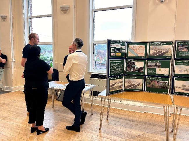

The event was very well attended. We had nearly 100 people through the door and lots of helpful feedback was provided by all of those who attended.

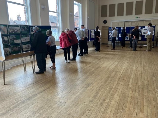
In general, people were really pleased to learn more about how the scheme had developed following our last public drop-in, in October 2022.
We have received several comments and questions and over the coming weeks we will consider if and how we can incorporate any further changes to the scheme in response to the suggestions made. The main comments received were around traffic management and communication around this. We have taken this feedback on board. We are already in the process of liaising with our traffic and transport partners, and we will update the community as soon as we have more information to share on how traffic and transport will be managed during the construction phase of the scheme.
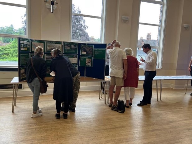

If you were unable to attend the session and you would like to see the materials that were shared on the day, please see the PDF display documents from the drop-in attached to the bottom of this page.
A Frequently Asked Questions document was shared on the day and is also available at the bottom of this page. This will be updated over the coming weeks with further answers to questions raised during the drop-in session.
If you missed the session, or if you have any further comments, we would be grateful if you would contact us by email at BLBFRMS@environment-agency.gov.uk
23 June 2023
TRAFFIC MANAGEMENT FROM 26.06.2023
There have been some traffic signs on the roads around Beales Corner in recent days, advertising upcoming road works. The road works will involve excavation of the road in order to divert Severn Trent services. These works are being undertaken by Severn Trent and are part of the preparation for the Environment Agency’s Beales Corner, Bewdley Flood Risk Management Scheme. The works take place from 26 June to 15 July.
Details of the road works are as follows:
- Road closure begins on Monday 26 June 2023
- The work is expected to take 3 weeks
- The work is being carried out on Stourport road only
- There are road traffic signs on the bridge, but the works will not affect the bridge
- The river side footpath will be closed due to the close proximity of the excavation
- The northern footpath will remain open at all times
- There will be people on site to assist pedestrians and answer questions
PUBLIC DROP-IN ON 27.06.2023
We are having a public drop-in event about the Beales Corner, Bewdley Flood Risk Management Scheme at St Georges Hall, Bewdley, from 12pm – 7pm on Tuesday, 27 June. Representatives from Severn Trent will also be in attendance at the event to answer questions. We would like to welcome the community to attend the drop-in to meet the team and learn more about the scheme.
May 2023
The planning consent was submitted on 16.12.2022 and was granted on 14.2.2023. The planning documents can be found here: 22/1034/FUL.
In February, we removed trees and vegetation along the waterfront by Beales Corner to help enable the works to start later in the year. New tree planting will be undertaken to mitigate for the lost trees, and we will be looking at ways to involve the community in this plan.
The project is moving forward, and we now anticipate that work will begin in late summer/early autumn 2023. There will be a drop-in event in summer to update the community on the scheme and the likely impacts from the construction phase. Further details will be announced on this when available.
February 2023
The planning application was submitted for the proposed scheme December 2022. The planning documents can be found here: 22/1034/FUL. We are hoping to receive planning permission in the coming weeks.
The ambition is for the main construction phase to begin in late summer/early autumn of 2023. From the 13 February we shall start the next phase of work that will enable the main construction works in the summer. This work is to remove trees and vegetation along the waterfront by Beales Corner and divert electricity and BT utilities. Once the scheme is completed new tree planting will be undertaken by the Environment Agency to mitigate for the lost trees.
- A road closure on Stourport Road from the entrance to Millside Court to the junction with Kidderminster Road;
- Two-way traffic lights on the Kidderminster Road (B4109) on the bridge ramp on the left bank of the River Severn
This traffic management will be in place for approximately three weeks from 13 February 2023. The Environment Agency understands the disruptions of traffic management and takes the impact that these works will have on businesses and properties very seriously. For this reason we have combined the tree removal works and the utilities diversion works to all be undertaken at the same time to minimise future impacts and avoid peak times like the Easter holidays.
December 2022
The planning application was submitted on 16 December 2022. All planning documents including the Flood Risk Assessment will be viewable on the Wyre Forest District Council planning portal once fully registered.
The team has had positive and productive meetings with the utility providers.

We have developed a good working relationship with the utility providers who will be undertaking vital service diversions ahead of the scheme.
October 2022
The Environment Agency held a drop-in event to update residents on progress on Beales Corner Flood Risk Management Scheme on Tuesday 18 October 2022.
The event was very well attended. We had 200 people through the door and over 50 people asked to be added to our mailing list.
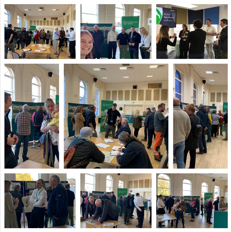
In general residents were really pleased to see our progress and the changes we made to the scheme following our last consultation in April.
We have taken away a number of comments and questions and over coming months we will consider if and how we can incorporate any further changes to the scheme in response to the suggestions made.
A Frequently Asked Question document was shared on the day and is available at the bottom of this page. This will be updated over the coming month with further answers to questions raised during the drop-in session.
If you missed the session, you can still contact us with any questions and comments through BLBFRMS@environment-agency.gov.uk.
September 2022
In September we received confirmation that the Outline Business Case had been approved. This is an integral part of project development and means that the project can progress through the planning application stage.
July 2022
We have been engaging with various stakeholders, including Wyre Forest District Council, Worcestershire County Council, Historic England and Natural England to prepare for the submission of the planning application. We will let the community know as and when the planning application is ready for submission.
We have also been engaging with utility companies about utilities which may be affected by our scheme. It is highly likely that we will need to undertake several utility alterations before being able to build the flood risk management scheme.
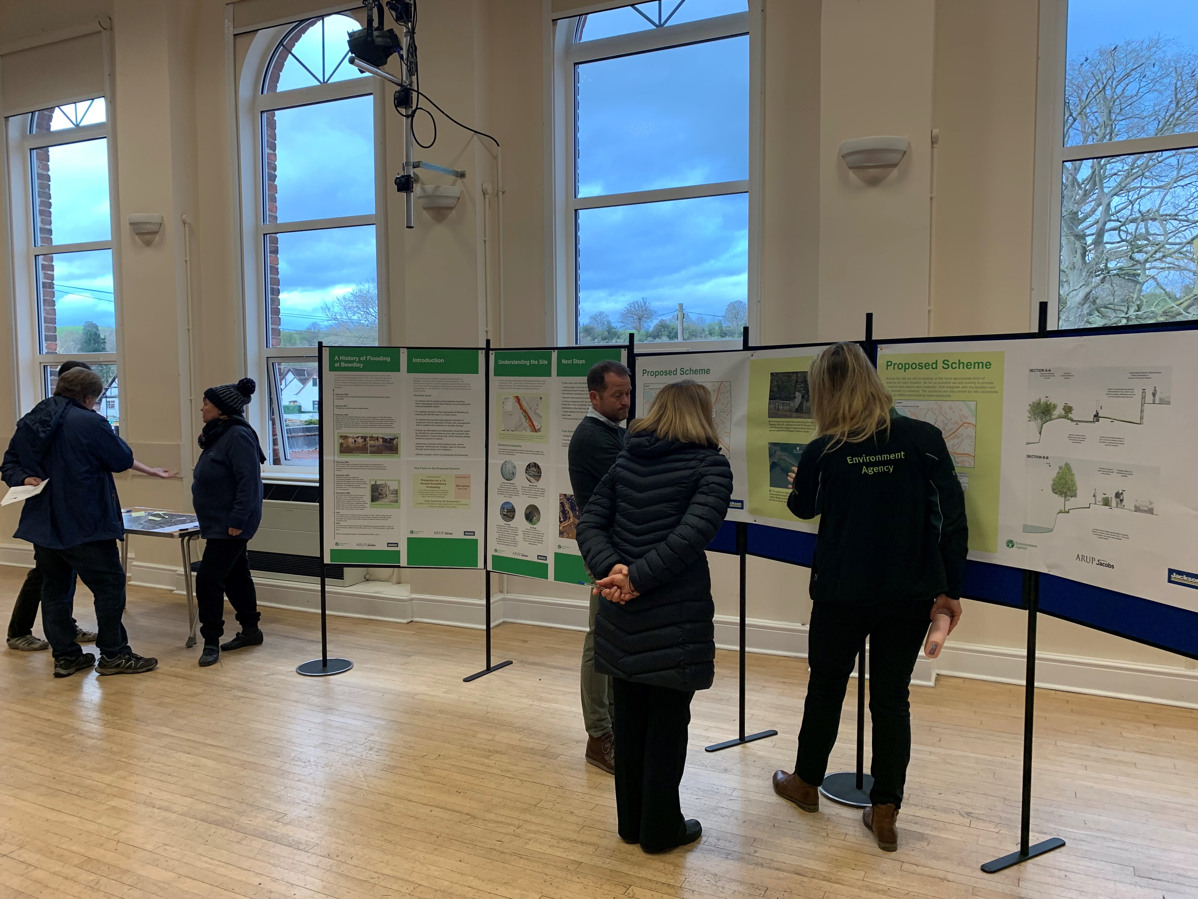
We have started engaging with the community, with a drop in event and a series of community meetings in the spring of 2022. We were pleased to see how well attended these sessions were. The photo below shows residents talking with our team at one of the community drop-in sessions in March
An online ‘Virtual room’ consultation was also made available to the community throughout May and June.
We would like to take this opportunity to say thank you to all the residents and partners who took part in these engagement sessions.
We will continue to engage with the community in the autumn 2022.
April 2022
The Environment Agency and partners met with residents and community representatives at St Georges Hall at a drop in event on 5 April 2022 to discuss the Environment Agency proposals for reducing flood risk at Beales Corner, Bewdley.
Following on from the face to face drop in session, we are now launching the materials used at the meeting as part of a virtual display of the flood risk management scheme proposals. You can view the draft proposals using the following link:
https://bealesfrms.virtual-engage.com/
This virtual room will be available for people to “visit” any time up until 30 May 2022. NB July 2022: Please note- this link has now expired
At this point no final decisions have been made and we are very keen to hear your feedback to help shape the final proposals that will then form part of the planning application later this year.
March 2022
The Scheme is progressing well but remains a complex and challenging scheme
We now have potential outline design and will be presenting this to landowners and the Bewdley community in the coming weeks to seek feedback.
Monday 14 March 2022 14:00 - 19:00 - Post flooding recovery session.
Environment Agency Incident Recovery Team at Bewdley Rowing Club. The recovery session was for people to talk about the most recent flooding- At this meeting the scheme wasn't discussed in detail, but residents were informed of and invited to future engagement event related to the scheme.
31 March 2022, 6.00pm to 8.00pm- Presentation to resident of Beales Corner
MS Teams presentation to residents to update on progress, inviting questions, concerns and comments
December 2021
Over the last months, we have been working with our partners and key stakeholders to develop a potential outline design of a potential flood risk management scheme.
Over recent months we have undertaken further surveys to help develop the potential outline We continue to work with Historic England and local planning authority to understand the historic and conservation impact on the preferred design.
We are talking with partners about mitigation for any environmental impacts the scheme may have. We are talking with the local Highways department to ensure the scheme has minimal impact on traffic flow.
Future developments
The project is progressing. We are undertaking the following activities:
- We are working with the utility companies to facilitate the relocation of services in preparation for the scheme.
- We are finalising the potential outline design, which will be shared with key stakeholders, the community and landowners at the beginning of 2022.
- We are preparing a community engagement meeting, which is likely to take place in January/ february 2022. Please keep your eyes out for our next newsletter with more information on the consultation.
- We are working with the Local Planning Authority to progress the planning application.
Temporary barrier post incident review at Bewdley
Following the flood incident in February 2021 we completed our Post Incident Review for the Beales Corner Temporary Barrier System in August 2021 and shared our findings with the public.
The full report is available at the bottom of this page, alongside a letter to residents which provides a summary and explanation of the findings. New measures recommended by the review during the recent high flows on 11 December 2021 and again in February 2022.
Sharing information with you
We want to make sure that the community is engaged with the project and kept informed of progress.
We will provide you with further information about the scheme in the following ways:
• Our online information page
• Information displayed on Town Council website
• Regular newsletters (at key project points) issued via email, please see how to sign up below.
• Virtual or face to face meetings at key project points
• We are also happy to attend any community meetings we are invited to
Signing up to our newsletter
It is important to us to keep you up to date on our progress with this scheme. If you would like to receive our newsletter and updates, please email your contact details to BLBFRMS@environment-agency.gov.uk
Alternatively, you call our National Customer Contact Centre during office hours on 03708 506 506 and we will add you to our mailing list.
PLEASE NOTE- By providing us with your contact details you consent to the Environment Agency using the details provided to contact you with updates about the Beales Corner Flood Risk Management Scheme.
We will keep your contact details until the project is closed or until you withdraw your consent, whichever is sooner. You can withdraw your consent to receive these updates at any time by emailing us at BLBFRMS@environment-agency.gov.uk or calling 03708 506 506.
We will not share your details with any other third party without your explicit consent, unless we are required to by law. The Environment Agency is the data controller for the personal data you provide. For further information on how we deal with your personal data please see our Personal Information Charter on GOV.UK (search 'Environment Agency personal information charter') or contact our Data Protection team. Address: Data Protection team, Environment Agency, Horizon House, Deanery Road, Bristol, BS1 5AH. Email: dataprotection@environment-agency.gov.uk
You can follow us on Twitter too at @EnvAgencyMids as we will be tweeting about the work we are doing on this scheme.
Remaining flood aware
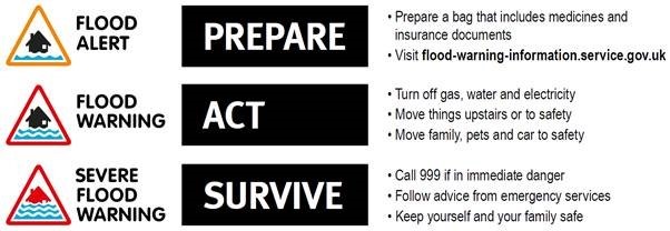
Please make sure you remain flood aware and ensure you are signed up to our flood warning service. Visit www.gov.uk/sign-up-for-flood-warnings or call 0345 988 1188 to sign up to get Flood Alerts and Warnings by phone, email and/or text message. This is a free service. Alternatively contact our Flood Resilience Engagement Advisors at Floodresilience@environment-agency.gov.uk
Know what to do when you receive a flood warning - use the 3 point plan.
Thank you for visiting our information page. Please keep visiting this page as we will be updating it regularly. This page will be open to the public until the end of construction.
If you have any feedback about this page, or use assistive technology (such as a screen reader) and need a version of any document in a more accessible format, please email BLBFRMS@environment-agency.gov.uk or call our National Customer Contact Centre on 03708 506 506.
Please tell us what format you need. It will help us if you say what assistive technology you use.
Give us your views
If you have any feedback about this page, or use assistive technology (such as a screen reader) and need a version of any document in a more accessible format, please email BLBFRMS@environment-agency.gov.uk
or call our National Customer Contact Centre on 03708 506 506.
Please tell us what format you require.
Audiences
- Businesses
- Charities
- Statutory organisations
- NGOs
- Members of the public
- Elected representatives, including MPs
- Local councils
- IDBs
- Local authorities
- District and parish councils
- Land owners
- Drainage associations
- RFCCs
- Members of the public
- Community groups
- Flood action groups
- Lead Local Flood Authorities
- Members of the public
- Town and parish councils
- Regional Flood and Coastal Committees
- Internal Drainage Boards
- Engagement specialists/operational staff in Natural Resources Wales, local authorities and other risk management authorities
Interests
- Flood management
- Specific projects, issues, or activity pages

Share
Share on Twitter Share on Facebook