Barton to New Holland Tidal Flood Alleviation Scheme - Information Page
Overview
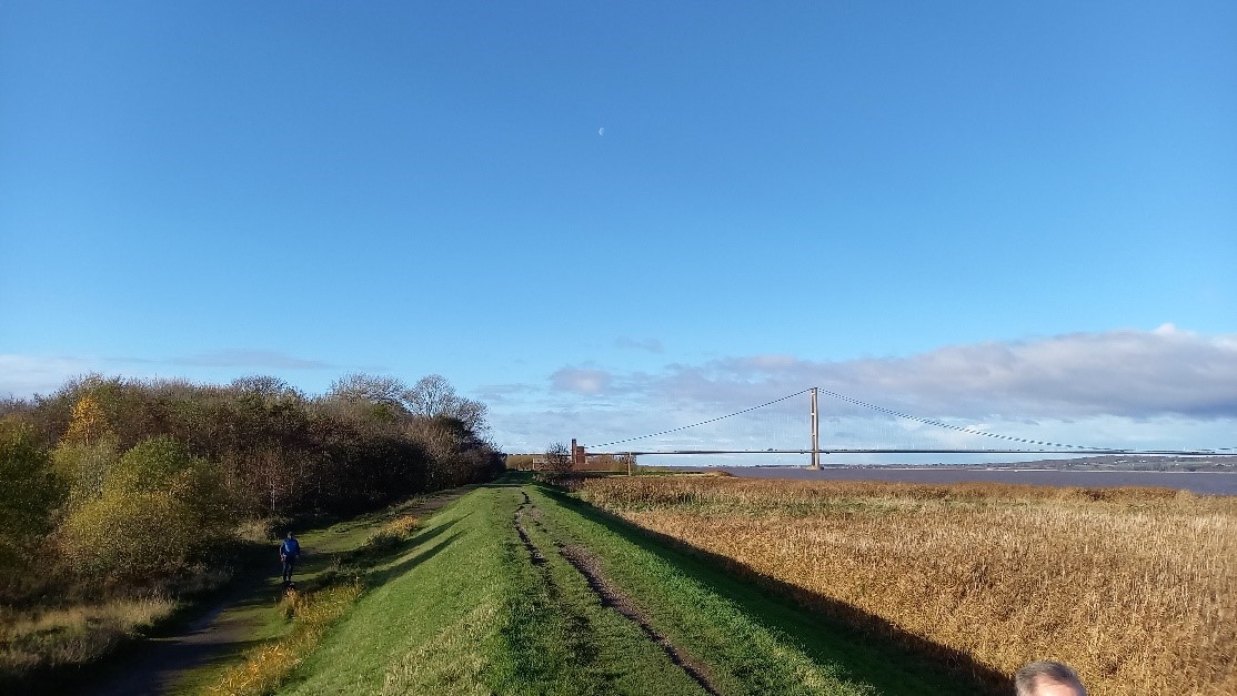
Welcome to the Barton to New Holland Tidal Flood Alleviation Scheme!
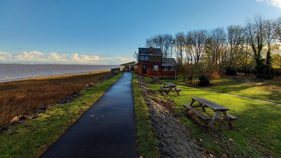
Flooding is a long-standing problem for the communities of Barton, Barrow, and New Holland. Previous tidal flood incidents have impacted lives, businesses, and homes. Highlighting the need for improved tidal flood defences and for communities in the area to be better prepared.
We are working with project partners Jacobs and Arup to develop a sustainable approach to reduce the impacts of tidal flooding, which is adaptable and resilient to the impacts of climate change.
On this page you will find the latest project news and progress updates as well as details of the project objectives and how you can get involved.
Contents
What is the Barton to New Holland Tidal Flood Alleviation Scheme?
What area does this project cover?
What is the flood risk in this area?
Who is involved in the project?
What are the projects objectives?
Viable Solution and Enhancement Measures
How are we engaging with our stakeholders?
What is the Barton to New Holland Tidal Flood Alleviation Scheme?
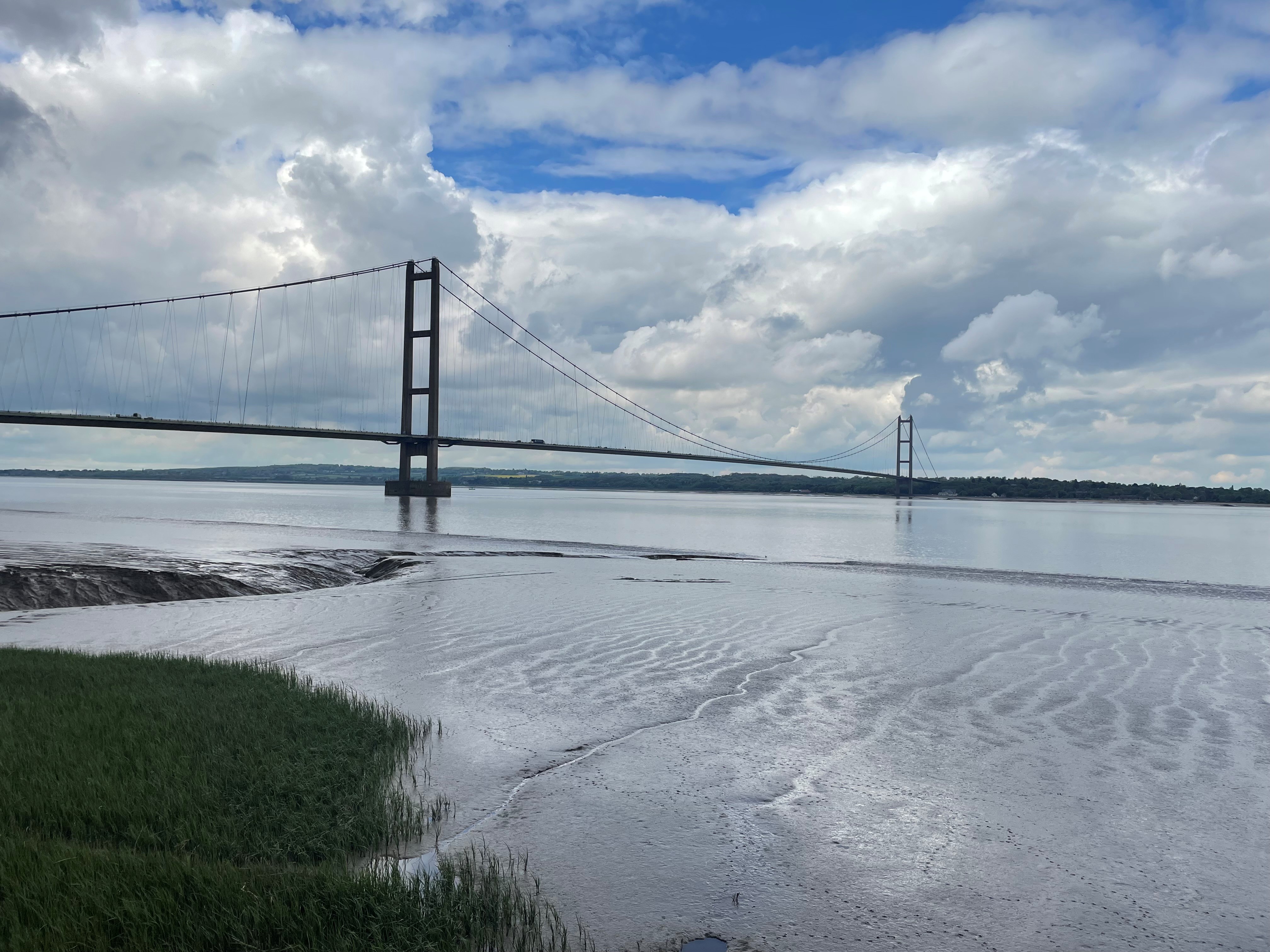
The Environment Agency is currently developing a new long-term strategy for managing flood risk around the Humber Estuary. The strategy provides an outline programme of the work needed to maintain the estuary’s flood defences for the next 100 years. One of the projects within this wider strategy is the Barton to New Holland Flood Alleviation Scheme.
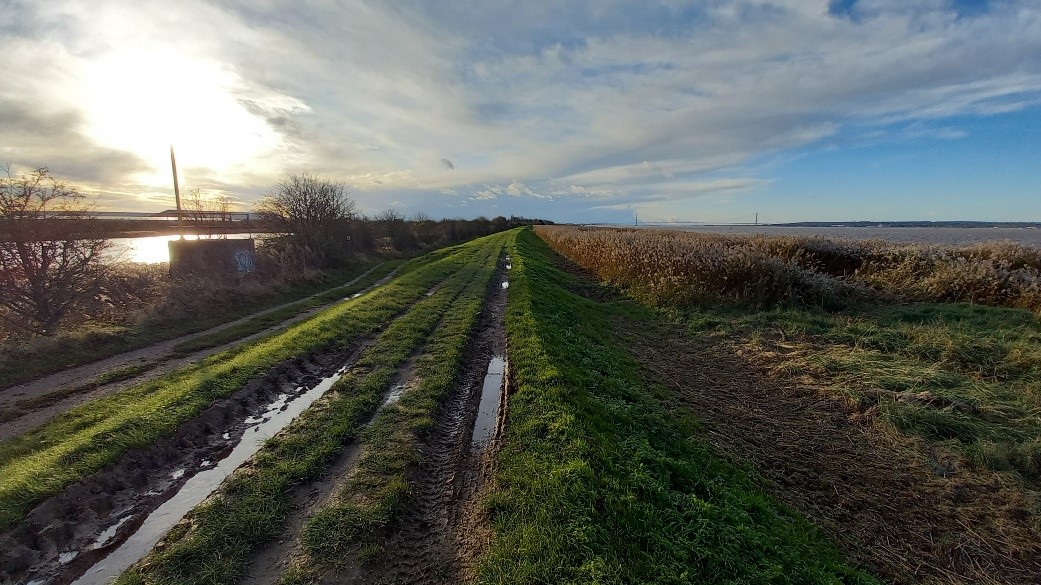
The communities of Barton to New Holland have been identified as one of 27 areas where defences need to be improved by 2028. Tidal flood incidents such as on the 5th of December 2013, also highlight the need for improved tidal flood defences and increased community resilience within these areas.
The Barton to New Holland Tidal Flood Alleviation Scheme aims to develop an approach to alleviate tidal flooding, which has communities and sustainability at its core.
Why is a project needed?
In December 2013, the communities from Barton to New Holland experienced their most significant tidal surge since 1953. Along with homes, businesses and a local school, extensive damage was caused to 3.5km of flood embankments which required large scale repairs throughout the winter and the following spring. Environment Agency flood models predict that a future tidal surge of a similar size or bigger than the December 2013 surge is likely to occur in the next 50 years.
Climate change is increasing the frequency and size of these flood surges and therefore, we need to adapt and improve existing defences as well as build new defences to help increase resilience and reduce the impact of major tidal flood incidents. There is no quick fix or short-term solution. This is a long process which will create a long-term sustainable solution.
Tell us!
There are many ways that you can keep up to date with the project; This website will be kept up to date with regular project updates and our next steps. We also have a project newsletter published quarterly, which explains key project milestones and the ongoing work of the team. If you would like to be added to the newsletter mailing list, please let us know by emailing us via the project email.
We understand the importance of our stakeholders and communities being informed and involved in the project, and we value your feedback and local knowledge.
You can contact us or sign up to our mailing list by emailing us at:
BartontoNewHollandFAS@environment-agency.gov.uk
You can download our latest stakeholder newsletter here:
December 2024 Newsletter
To be added to our mailing list for this newsletter email us at BartontoNewHollandFAS@environment-agency.gov.uk
What area does this project cover?
The area of focus is from Barton Cliff to New Holland Docks. The red line shown on the map shows the extent of the scheme boundary.
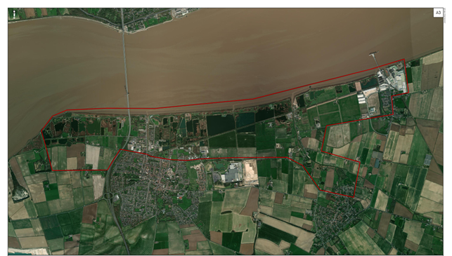
Image description: The red line on this map shows the extent of the project boundary.
More Information
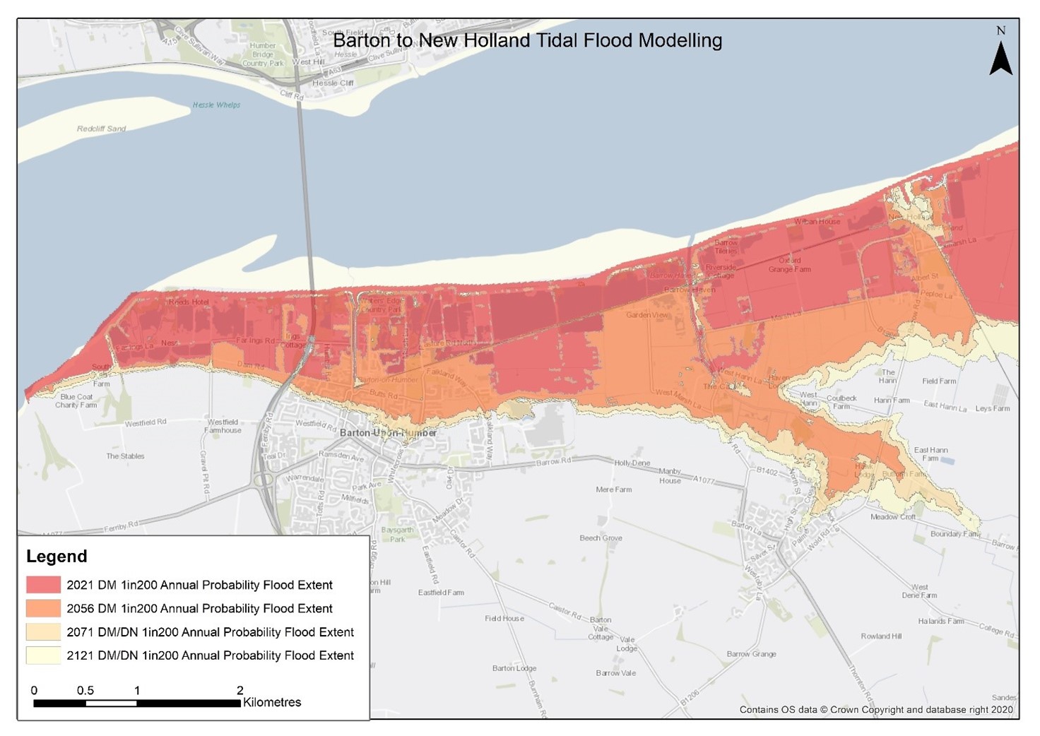
Image description: Composite Tidal Flood Modelling showing 1 in 200 (0.5%) Annual Exceedance Probability scenario over the next 100 years. Note: the extent shown assumes that breaching occurs prior to 2056. Thereafter, Do Minimum and Do Nothing are the same, as defences are overwhelmed more regularly, and the natural flood plain broadly fills to a deeper depth.
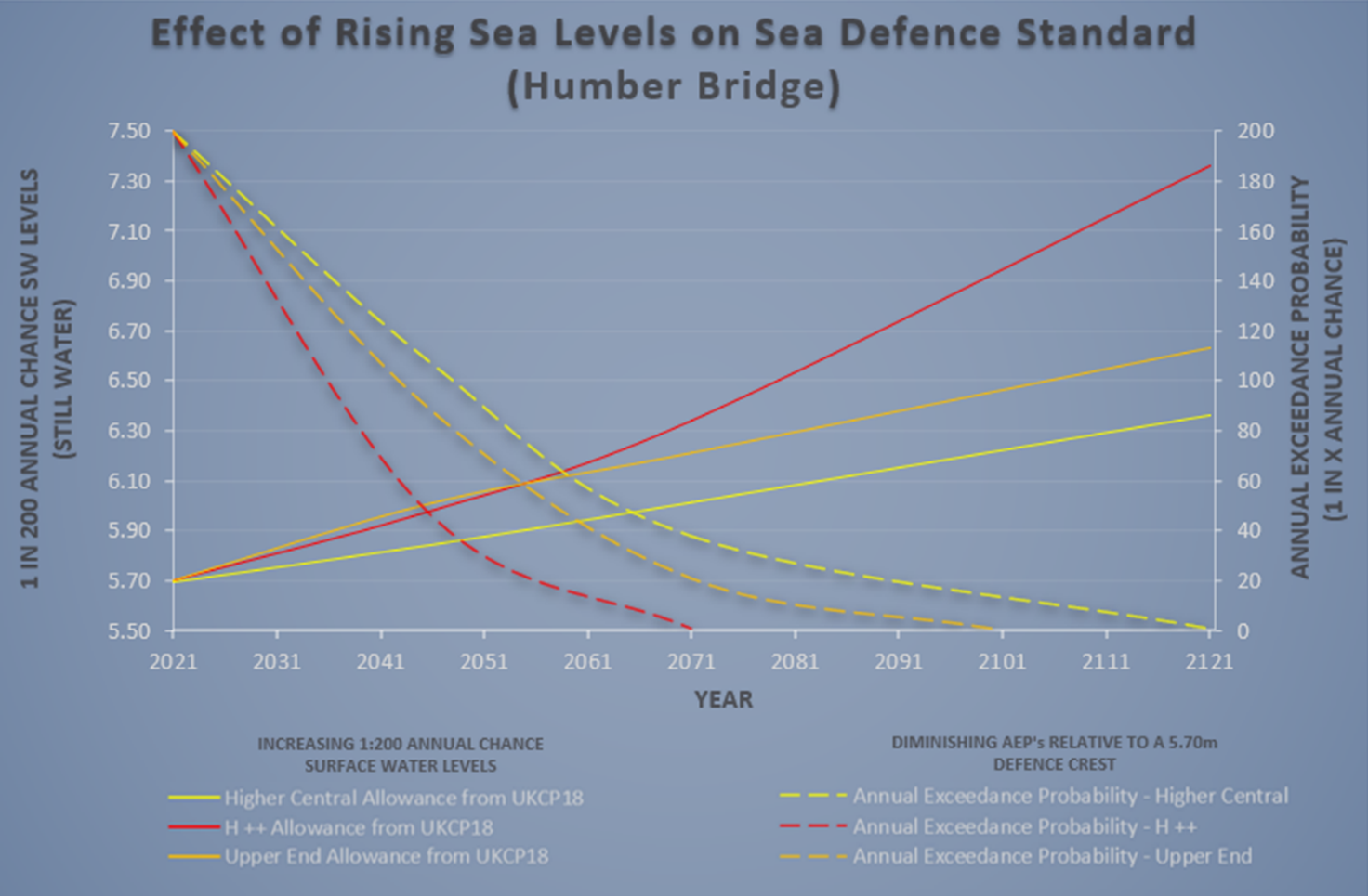
Image description: Predicted sea level rise for a range of 1in200 annual chance water levels and associated reduction of Annual Exceedance Probability of a typical existing embankment near to the Humber Bridge. The ranges are determined using three standard climate change prediction scenarios up to 100 years into the future.
Key words:
Alleviation – The process of making a problem less severe.
Scheme Boundary – The area in which the scheme works will take place and where the outcomes and benefits of the project will be felt/seen.
Biodiversity Net Gain – The process of increasing the overall biodiversity value of a development site. It aims to leave the natural environment in a better state than prior to development.
Sustainability – The ability to maintain a process continuously over time to the same standard.
More Information
The Environment Agency have partnered with Arup and Jacobs to develop a sustainable and resilient tidal flood defences for the coastal frontage and communities between Barton and New Holland.
Working with local stakeholders and communities we will use local knowledge, alongside the surveys, land investigations and modelling of our technical specialists, to help shape our designs for tidal defences with the long-term goal of improving resilience to future flooding and the impacts of climate change.
What are the projects objectives?
More Information
More Information
More Information
More Information
Viable Solution and Enhancement Measures
We have been working to develop designs within the constraints of the project which not only improve the levels of protection to residents and businesses but also improve the conditions of the natural environment.
Currently, we have developed two designs – The Viable Solution and The Enhancement Measures. These designs are not final and will continue to be developed.
The Viable Solution:
The viable solution includes raising defences and additional resilience interventions to identified areas across the Humber frontage
It is referred to as the ‘viable solution’ as we believe it is currently deliverable within the technical, economic, archaeological, and environmental constraints of the project.
The environmental constraints are important to consider as these protect the valuable and diverse habitats of the Estuary and clay pits. These ‘designated sites’ can only be developed and changed under very strict regulations which limit the amount and nature of the work that can be carried out.
The map below showcases the areas being considered for embankment improvement/low spot raising, alternate raising solutions as well as areas where no raising is required.
Enhancement Measures:
Our enhancement measures are a series of measures, of which a selection/combination could be delivered in addition to the viable solution if further funding can be obtained.
Enhancement measures include the construction of cross bunds, improved defences, and a relocated outfall. Bunds are a form of flood management used as a barrier to prevent the spread of flood water across the tidal flood plain. They are generally made of earth and formed into a linear mound.
These measures will further reduce the flood risk to the communities but can only be delivered if additional funding can be obtained. The project team are currently exploring funding solutions.
If further funding is not able to be found soon, alternately, the enhancement measures could also be implemented at a later stage (for example, after 2055). This would provide adaptation to further climate change impacts, once these are better understood, after completion of the Humber 2100+ strategy. More information on the Humber 2100+ strategy can be found on our virtual engagement website.
The map below displays the enhancement measures being considered, including the relocation of the Barrow Haven outfall, cross bunds, and improved defence resilience.
Our final design is likely to be a combination of the viable solution with some elements of the enhancement measures.
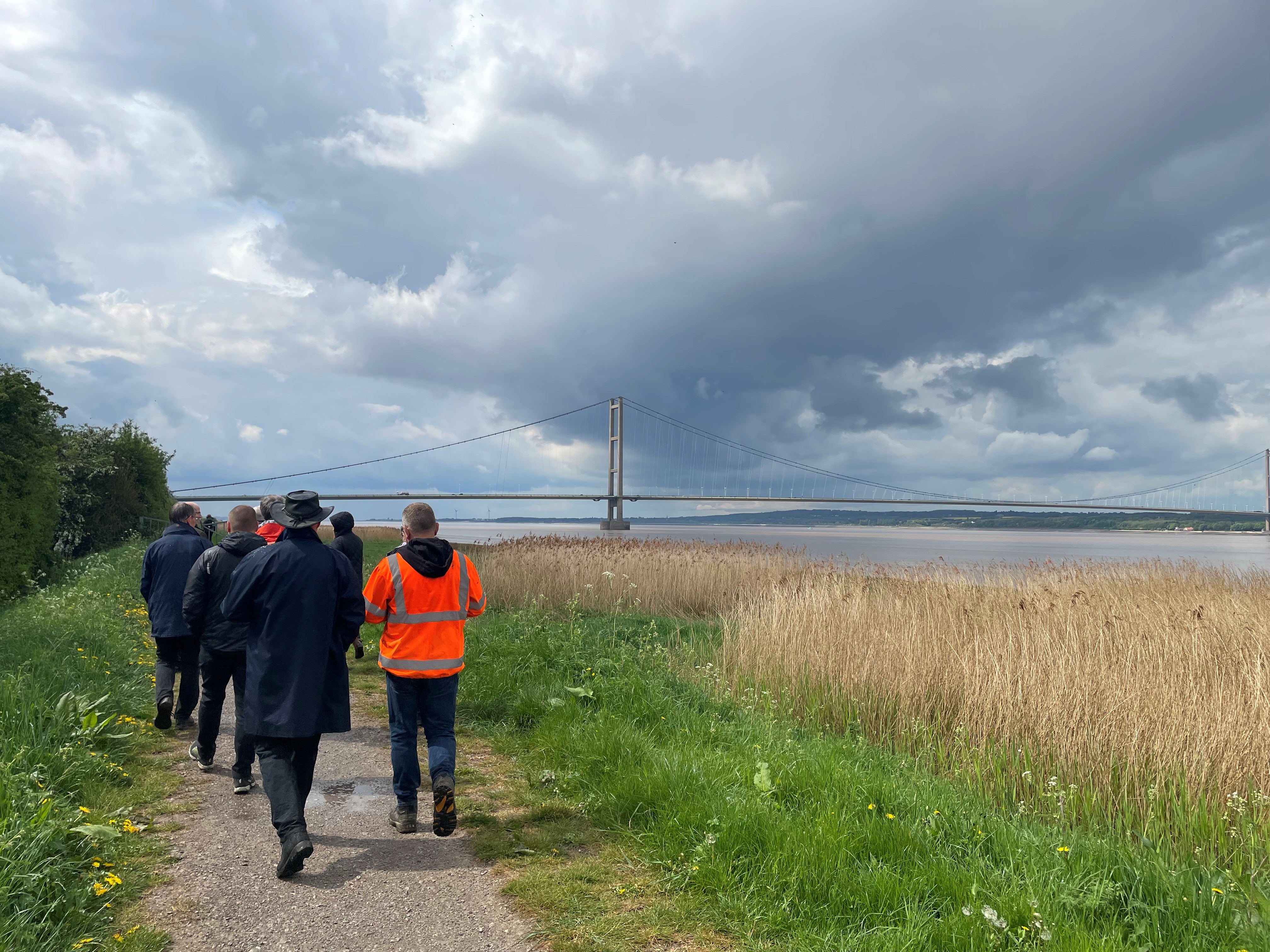
How are we engaging with our stakeholders?
We are committed to keeping the local community and our stakeholders informed and engaged throughout this project. To do this we have set up community working groups such as our Resilience Advisory Group and Steering Group.
These groups are made up of invited local residents, councillors, and representative from agencies and community groups such as Natural England, Lincolnshire Wildlife trust and the Clay Pits group. The groups meet with the project team quarterly to discuss the work we have been doing and the importance of our ongoing surveys and landscape investigations which inform our options development.
Virtual Event:
We have developed a ‘virtual event’ which is a replica of the room and materials shared at our February 2024 community drop in events, to allow you to revisit and easily browse our project information including our viable solution and enhancement measure maps at any time!
You can navigate around the room using the arrows on the tool bar at the bottom of the screen and enlarge and view information using the blue icons on the board.
If you see something at our virtual event that you would like to know more about, or have any questions please do not hesitate to contact us via BartontoNewHollandFAS@environment-agency.gov.uk
Community Drop-in Events February 2024:
In February, we held three community drop-in events across New Holland, Barton and Barrow Haven. The purpose of these events was to share with you our viable solution and enhancement measures and hear your views and feedback.
We spoke to over 190 residents, business owners, local councillors and member of the wider community across the events and collected vital feedback to aid us in developing our designs, business case and the best approach to maximise community benefits.
As well as sharing the schemes current proposals, we provided insights and updates on our environmental surveys, ground investigations, archaeological and heritage studies and information on how this project fits into the wider Humber 2100+ strategy. If you were unable to attend our events, you are still able to view all the information shared on our Virtual Event site - Barton to New Holland Tidal Flood Alleviation Scheme (virtual-engage.com). If you have any questions for the team, you can contact us via BartontoNewHollandFAS@environment-agency.gov.uk
How will the project be funded?
A ‘partnership funding approach’ is used to calculate funding allocations for flood risk management projects. This approach allows for worthwhile projects (where benefits are greater than the overall cost) to qualify for government money, known as a Grant in Aid.
Funding is then calculated using a tool known as the partnership funding calculator. This tool works out the amount of Grant in Aid a project is entitled to, and the minimum amount of contribution it needs to obtain to complete the scheme. Where there is funding shortfall the project team will look for possible funding contributions from partners and key stakeholders.
Funding may also be obtained from other sources in relation to the delivery of benefits beyond the reduction of flood risk (i.e., additional sustainability, environmental and community benefits).
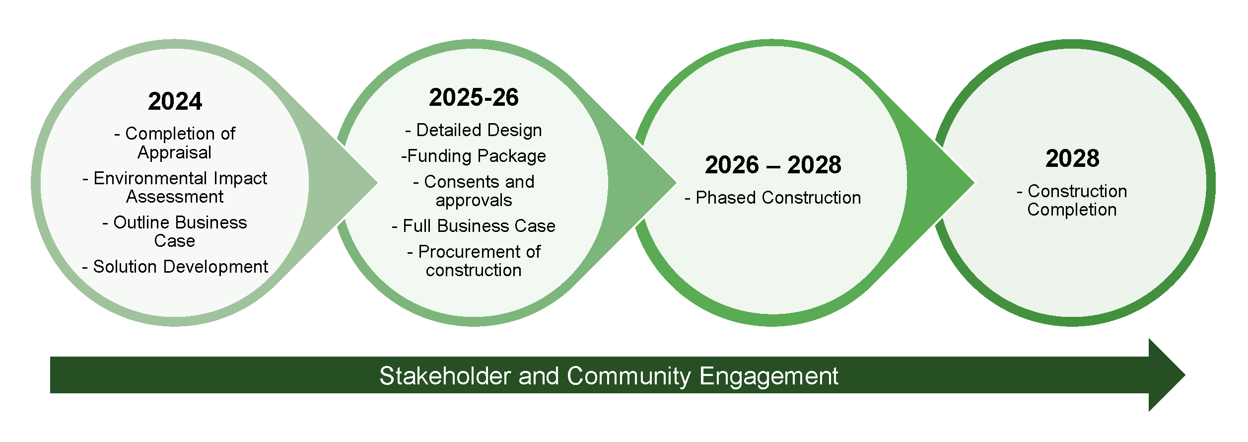
Project timeline
Below is a timeline of how the project is expected to progress over the next 5 years from options development stage, through to the design stage and finally the construction and post construction phases. All phase timings are subject to change.
More Information
Events
-
New Holland Community Centre community event
From 20 Feb 2024 at 09:00 to 20 Feb 2024 at 12:00Join us at the New Holland Community Centre to find out more about the Barton to New Holland Tidal Flood Alleviation Scheme.
Address: New Holland Community Centre, Barrow Road, DN19 7RR.
-
The Ropewalk community event
From 22 Feb 2024 at 12:00 to 22 Feb 2024 at 20:00Join us at The Ropewalk to find out more about the Barton to New Holland Tidal Flood Alleviation Scheme.
Address: The Ropewalk, Maltkiln Road, DN18 5JT.
-
Haven Inn community event
From 23 Feb 2024 at 12:00 to 23 Feb 2024 at 17:00Join us at the Haven Inn to find out more about the Barton to New Holland Tidal Flood Alleviation Scheme.
Address: Haven Inn, Ferry Road, DN19 7EX.
Audiences
- Businesses
- Charities
- Community groups
- District and parish councils
- Drainage associations
- Elected representatives, including MPs
- Elected representatives, including MPs
- Engagement specialists/operational staff in Natural Resources Wales, local authorities and other risk management authorities
- Environment Agency customers
- Environmental bodies
- Farming associations
- Flood action groups
- Flood Resilience Forums
- IDBs
- Internal Drainage Boards
- Land owners
- Lead Local Flood Authorities
- Local authorities
- Local councils
- Local Risk Management Authorities
- Members of the public
- Members of the public
- Members of the public
- Members of the public with an interest in the river, the species and conservation
- NGOs
- Recreational and commercial river users
- Regional Flood and Coastal Committees
- RFCCs
- Somerset Rivers Authority
- Statutory organisations
- Town and parish councils
- Water companies
Interests
- Flood management
- Specific projects, issues, or activity pages
Share
Share on Twitter Share on Facebook