River Wharfe and Ilkley bathing water site information page
Overview
Welcome to the River Wharfe and Ilkley bathing water site information page
River Wharfe catchment
The River Wharfe and its tributaries flow from the headwaters in the Yorkshire Dales National Park down to its confluence with the River Ouse near Cawood. Along the way it passes through a number of villages and towns including Kettlewell, Grassington, Addingham, Ilkley, Otley, Wetherby and Tadcaster.
The Environment Agency, along with many partner organisations, is taking a catchment-based approach to managing our river systems and their habitats. This takes into account the many factors which influence and impact on river catchments. This Information Page will introduce some of the key environmental issues we are currently addressing in the Wharfe catchment, including water quality, pressures on fish and biodiversity, impacts of agriculture, and flood risk management (including Natural Flood Management measures). It also provides information about the new bathing water site in Ilkley, and how we are monitoring water quality to help keep people safe and healthy when using the river.
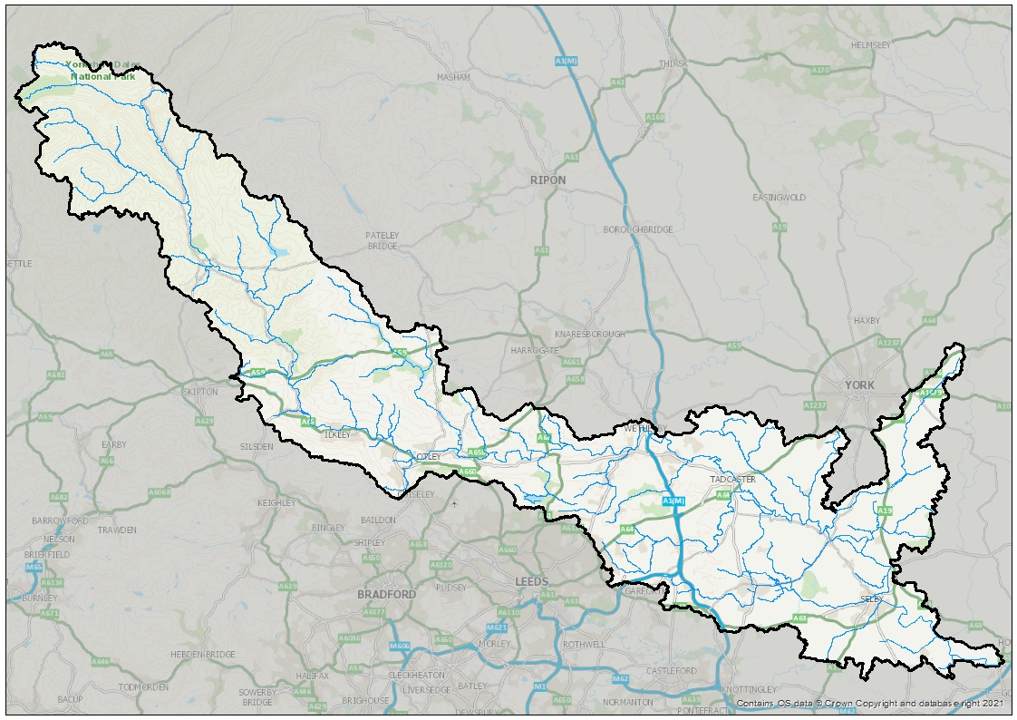
Map of the River Wharfe catchment
More Information
Key issues in the Wharfe catchment
- Water quality: A significant part of our role in Environment Management is to regulate private and water company discharges. There are increasing pressures on the sewer network due to population growth in the River Wharfe catchment. Recently, due to the Covid-19 pandemic, more rural and smaller sewage treatment works have been under higher pressure due to the increase in home working. Additionally an increasing number of people are travelling and staying at campsites, caravan parks and hotels within the country rather than venturing abroad, meaning these systems are under more strain. We work with the operators of these systems to ensure that they are adequately maintained and do not impact on the water quality of the streams they discharge to.
A number of factors including specific pollution events, diffuse run off and point source discharges (both permitted and non-permitted) combine to impact upon water quality in the River Wharfe and its designated bathing water. These inputs include a number of streams flowing into the River Wharfe which receive run off from both urban and rural areas. Permitted discharges in the vicinity of the bathing water include Rivadale View Combined Sewer Overflow and Bridge Lane Pumping Station. These have the potential to impact upon water quality when they operate. Ilkley Sewage Treatment Works, downstream of the bathing water, is permitted to release treated effluent, combined sewer overflow and emergency discharges to the river. You can find more information about permitted discharges near to the Ilkley bathing water site on Swimfo.
We continue to work closely with a range of partners to reduce pollution and other significant inputs in order to improve water quality at the bathing water and in the wider catchment. Water companies, councils, campaign groups, farmers, local businesses and communities all have a part to play in protecting and improving water quality.
- Pressures on fish and biodiversity: We are looking to open up fish spawning habitat all the way up the River Wharfe to Bolton Abbey, by addressing problems caused by a lack of appropriate fish passage over some major weirs.
There are a number of Fisheries Improvement Fund projects being delivered in the Wharfe catchment. These include habitat improvements in the Upper Wharfe/Wray Beck at Buckden, and riparian fencing, tree planting and willow spiling on the River Wharfe below Burnsall.
- Impacts of agriculture: The River Wharfe catchment, upstream of Ilkley, is largely agricultural, with mainly low intensity livestock farming in the upper reaches. We work with farmers along the entire catchment to reduce the effects of farming on water quality. We provide advice to farmers on how to comply with regulations and good practice on farms to ensure that pollution entering watercourses is minimised.
- Flood risk management: There is an ongoing Defra-funded pilot Natural Flood Management project on Ilkley Moor and Backstone Beck, which joins the Wharfe at Beanlands Island, downstream of Ilkley Wastewater Treatment Works. We are assisting with delivery of this project in partnership with City of Bradford Metropolitan District Council.
We are also developing a new flood alleviation scheme for Tadcaster on the River Wharfe, working with the town's residents, businesses and other stakeholders. More information about the scheme can be found here.
Working in partnership
The Dales to Vale Rivers Network is the catchment partnership for the Wharfe and Lower Ouse, hosted by the Yorkshire Dales Rivers Trust. The network includes local authorities, landowners, Wildlife Trusts and community groups. You can access information about the Catchment Partnership here: YDRT
The Environment Agency’s Wharfe Flood Partnership (a sub group of the Dales to Vale Rivers Network Catchment Partnership) have developed Local Levy bids in recent years to address community resilience to flooding. This is a partnership made up of the Environment Agency, Local Authorities and the Yorkshire Dales Rivers Trust. The funding has been spent in Addingham, Collingham and Tadcaster.
There are a number of partnership projects delivering improvements to water quality in the Wharfe catchment. A project known as “Rivers In Elmet” is being led by the Yorkshire Dales Rivers Trust, to investigate water quality problems and sediment management. Several streams in the Wharfe catchment are included in the project - Collingham Beck, Cock Beck near Stutton, and Thorner Beck.
Additionally, Harewood Estate are delivering a Water Environment Grant project to address water quality in Stank Beck, which runs through their estate, and Natural Flood Management measures to slow the flow of water.
The Yorkshire Dales Rivers Trust is leading delivery of an Upper Wharfe SSSI (Site of Special Scientific Interest) project which is restoring priority habitats in Upper Wharfedale and mitigating the impacts of historic flood defence works. The Trust is aiming to extend the project to incorporate Natural Flood Management measures, looking at the impact of woodland planting on flood risk.
The Yorkshire Dales Rivers Trust have also adopted the “iWharfe” project. This started out as a Citizen Science project, alongside local community groups such as the Ilkley Clean River Group and the Addingham Environment Group. The purpose of the project is to investigate the effects of water quality on human health and wildlife in the River Wharfe, and to raise awareness of the sources of faecal bacteria contamination.
The Environment Agency continues to support and engage with the iWharfe, Wharfe Riverfly and Addingham 4 Becks projects, providing technical input to the groups and reviewing the data they produce.
Monitoring work has also been undertaken to support the Addingham 4 Becks project. Invertebrate and diatom (microalgae) samples were taken and analysed from Town Beck in Addingham to better understand the ecology of the waterbody and local pressures.
The Collingham Beck Community Natural Flood Management project, led by Yorkshire Dales Rivers Trust in partnership with Mott Macdonald and East Keswick Wildlife Trust, received funding from Defra to mitigate the impacts of flooding.
The Dales to Vale Rivers Network are delivering the “INNS Out!” project to tackle invasive plant species in a number of river catchments including the Wharfe.
Ilkley bathing water site – background
The River Wharfe in Ilkley is a popular location for recreational bathers, particularly during the summer months. Following concerns around the water quality in the area, a group of local residents formed the Ilkley Clean River Group and campaigned for its designation as an official bathing water site. Supported by the City of Bradford Metropolitan District Council, Ilkley Town Council and Yorkshire Water, the group submitted an application for bathing water status to Defra in October 2019. On 10 August 2020 an eight week public consultation was launched which closed on 2 October 2020. The bathing water site (known as “Wharfe at Cromwheel, Ilkley”) was designated on 22 December 2020. It is the first designated river bathing water site in England.
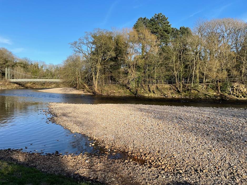
Ilkley bathing water site on the River Wharfe
Who is responsible for managing bathing water sites?
The Environment Agency is responsible for monitoring the quality of bathing waters to make sure regulations are being complied with. We take compliance samples and undertake investigations of bathing waters classified as less than sufficient.
Local councils must provide information at designated bathing waters during the bathing water season (15 May to 30 September). City of Bradford Metropolitan District Council are the beach managers for Ilkley bathing water, and are responsible for providing site signage.
How do we monitor water quality?
Under the Water Framework Directive (WFD), a river is classified with regards to its chemical quality (ammonia, phosphate, temperature, pH, chemicals, metals) and biological quality (invertebrates, fish, plants), and its physical condition.
During 2021 the Environment Agency carried out invertebrate, macrophyte and diatom surveys of the seven waterbodies making up the River Wharfe from the top of the catchment to the confluence with the River Ouse. Water chemistry samples were also collected from the seven waterbodies. The results of this monitoring will allow us to provide a classification of Water Framework Directive (WFD) status for 2021.
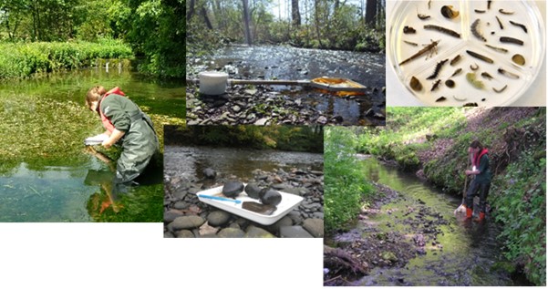
Invertebrate and diatom monitoring
How do we monitor bathing water quality?
Under the Bathing Water Directive, designated bathing waters are classified using different parameters which measure the concentration of faecal indicator organisms (bacteria) found in the water.
The standards used to assess river water quality, for example for fish and invertebrates, do not include bacterial indicators as these have little effect on those organisms. It is therefore possible that a Good or High classification for WFD is achieved but the required standard for bathing water is not met.
Each year, every site designated under the Bathing Water Directive receives a water quality classification. The Environment Agency collects samples regularly during the bathing water season which runs between 15 May and 30 September. We measure the number of certain types of bacteria in the samples. High concentrations of these may indicate the presence of pollution, mainly from sewage or animal faeces (including birds), and a decrease in water quality.
There are four classifications of bathing water quality:
Excellent – meaning the highest, or cleanest, class;
Good – meaning generally good water quality;
Sufficient – meaning the water meets minimum standards;
Poor – meaning the water has not met minimum standards.
2021 bathing water classification results
The 2021 bathing water classification results for England were released on 19 January 2022, and showed that 16 of the 18 designated bathing beaches in Yorkshire secured an ‘Excellent’ or ‘Good’ rating, with two achieving the minimum ‘Sufficient’ rating. The bathing water site at Ilkley on the River Wharfe was classified as Poor.
This is the first year that the Ilkley bathing water site has been given an official classification after being added to the list of bathing waters in 2021.
Initial investigations this year by the Environment Agency and partners suggest a variety of bacteria sources including human and animal DNA are impacting water quality in the River Wharfe.
While a designation is an important first step towards longer-term water quality improvement, it will take time to identify how to meet the required bathing water standards alongside the financial investment and co-operation needed to make it happen. To help achieve this, the Environment Agency is working with other organisations through the Dales to Vale River Network (DVRN) - the catchment partnership for the Wharfe and Lower Ouse, hosted by the Yorkshire Dales Rivers Trust. The network includes local authorities, landowners, Yorkshire Water, Wildlife Trusts and community groups, and coordinates research and actions.
More Information
Water quality investigations
Over the summer of 2021 the Environment Agency carried out a series of water quality investigations on the River Wharfe.
Intensive survey days
In addition to the routine bathing water compliance monitoring which took place between May and the end of September (when 20 samples were collected), we undertook three days of investigatory bacteria monitoring at the bathing water site at Cromwheel and at another point upstream on the River Wharfe at Bolton Bridge. Samples were collected every 30 minutes between 09:30 and 17:00 at the two sites on 16 August, 14 September and 6 October 2021.
The aim of this monitoring was to try and establish whether there were any changes in the concentrations of the bacteria Escherichia coli (E. coli, EC) and Intestinal enterococci (IE) over the course of the day, and whether there were any distinct differences in bacterial concentrations between the two sites. The Bolton Bridge site was chosen as it was upstream of the urban areas of Ilkley and Addingham.
More traditional water quality readings (dissolved oxygen, pH, conductivity, temperature and ammonium measurements) were also taken using a hand-held meter, alongside the bacteria samples.
An additional six bacteria samples were taken at other locations throughout the catchment on 6 October 2021.
In total 102 bacterial samples and 12 physical chemistry samples were collected as part of our investigations.
Continuous water quality monitoring
Continuous water quality monitors (sondes) were installed at three sites in the River Wharfe from late June 2021; these were near Grassington, Bolton Bridge and at the bathing water site at Cromwheel. A sonde is an instrument that automatically measures and transmits information about river water quality. Each sonde provides live data feeds every 30 minutes on the temperature, conductivity, dissolved oxygen, pH, ammonia and turbidity of the River Wharfe at these locations.
The sondes allow us to have a clearer view of water quality in the mid Wharfe catchment and provide a much more accurate reflection of water quality in a river compared with traditional monthly spot sampling. The information gathered by the sondes should also enable us to start to better understand possible points of origin and travel time of organic pollutants through the river.
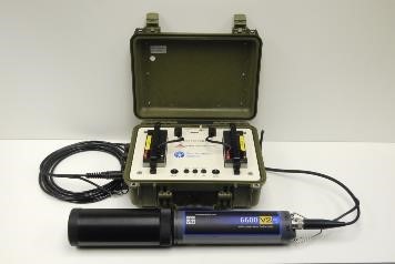
Sonde kit (continuous water quality monitor)
The sondes were removed from Bolton Bridge and Grassington at the end of the 2021 bathing water season. The sonde at Ilkley remains in situ at present to support ongoing work. You can view the data from the sonde at Cromwheel, Ilkley, via the link here, or by using the QR code below:

Spatial bacteria monitoring
During summer 2021, spatial bacterial surveys were undertaken along the River Wharfe and several of its tributaries on eight occasions. This included six surveys using a portable Fluidion bacteria monitor. The Fluidion system allows us to conduct rapid analysis of E. coli concentrations in water samples without the need for laboratory analysis. A total of 36 samples were collected and analysed using this method, whilst another 12 bacteria samples were submitted to the Environment Agency’s laboratories for analysis.
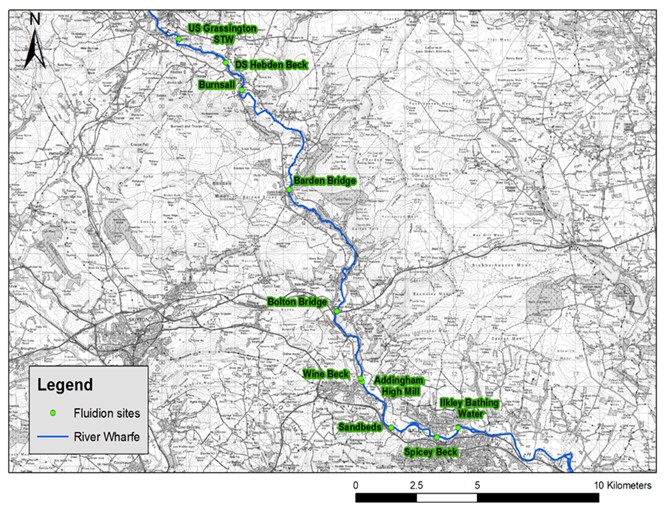
Map of catchment sampling locations
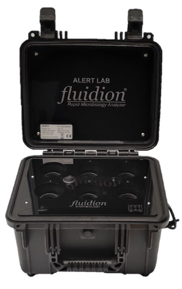
Portable Fluidion kit
Work is underway to re-install a fixed Fluidion monitor at the bathing water site at Cromwheel, Ilkley, ready for the 2022 bathing water season. This system can be triggered remotely, and we hope it will allow us to better investigate the impact of rainfall and flow events on bacterial concentrations at the bathing water site.
We also conducted a drone survey of the River Wharfe through Ilkley, with the aim of identifying potential pollution sources within the town.
Microbial source tracking of bacteria samples
21 of the bacteria samples collected from the sites at Cromwheel and Bolton Bridge were analysed by the Environment Agency’s laboratories for the presence of human and ruminant (sheep and cows) DNA. The results of this analysis will enable us to start to understand which, if any, are the dominant sources of bacteria in the river, and if this changes under different conditions.
Ilkley bathing water site information
The bathing water site, known as ‘Wharfe at Cromwheel, Ilkley', is located on the River Wharfe at Ilkley, close to Ilkley town centre. It can be accessed from the Riverside Walk footpath alongside the river. When the river level is low, a gently sloping shingle beach is exposed. The Cromwheel sampling point is located upstream of the suspension bridge and upstream of all discharges from Ilkley Sewage Treatment Works. This point was chosen as it was representative of where most bathers access the water.
During the 2021 bathing water season we also collected samples at Bolton Bridge and at the Stepping Stones. Evidence collected at the Stepping Stones indicates bathing water quality downstream of Ilkley Sewage Treatment Works never meets minimum standards. Bathing here should be avoided.
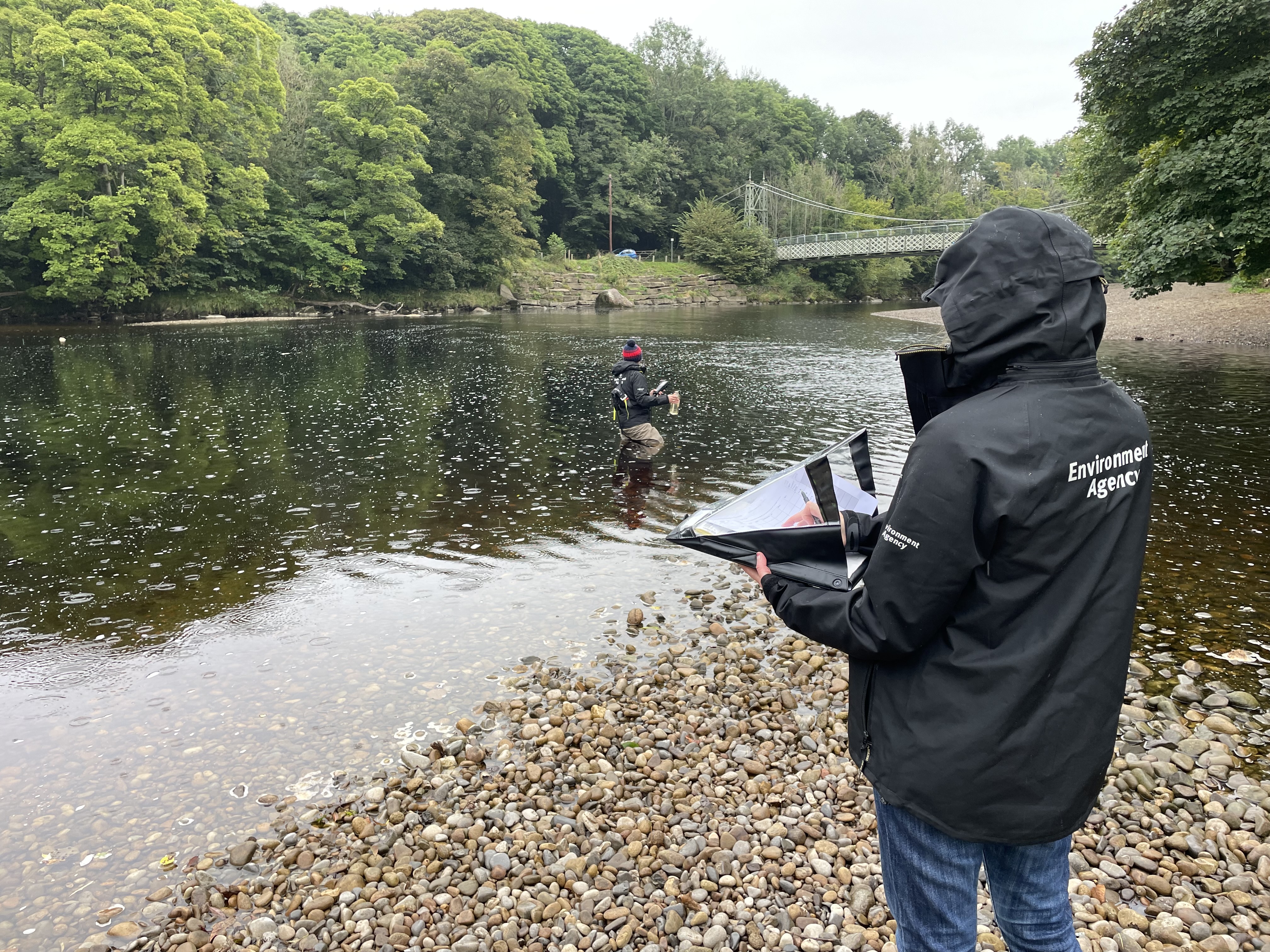
Environment Agency Officers collecting water quality samples at the bathing water site
Signage is displayed by City of Bradford Metropolitan District Council at the Environment Agency’s monitoring point.

Signage at the Cromwheel sampling point
Further information
Additional information about the Ilkley bathing water site can be found on our Swimfo website. The bathing water profile for this site provides information about the Environment Agency’s sampling point, water quality sampling results, the 2021 classification result, and a summary of our knowledge of pollution sources in the catchment.
The Catchment Data Explorer allows you to explore and download information about the water environment. You can find catchments and waterbodies using the map or searching by name. You can also view summary information about catchments and follow links to other useful sites. It supports and builds upon data in the River Basin Management Plans (RBMPs).
Audiences
- Recreational and commercial river users
- Fishing clubs and representative associations
- Members of the public with an interest in the river, the species and conservation
- Members of the public
- Elected representatives, including MPs
- Local councils
- All water abstractors
- Environment Agency customers
- Farming associations
- Water companies
- Community groups
- Town and parish councils
Interests
- Business and industry
- Flood management
- Water resources
- Water quality
- Habitats and wildlife
- Permits

Share
Share on Twitter Share on Facebook