River Slea Flood Resilience Project
Overview
Welcome to the River Slea Flood Resilience Project!
This webpage contains up to date project information, including the latest newsletters, upcoming events and key project updates. This page will be regularly updated to keep you informed and aware of project progress.
Contents
What is the River Slea Flood Resilience Project?
The River Slea, located in Sleaford, Lincolnshire, is a 36km tributary of the River Witham. Throughout history, the River Slea has undergone modifications for a range of uses, including water abstraction, milling and navigation. In 1872, the River Slea was described as “a never-ending source of fresh water”. Fast forward to 2023 and this is no longer the case with the Slea suffering from very low flows.
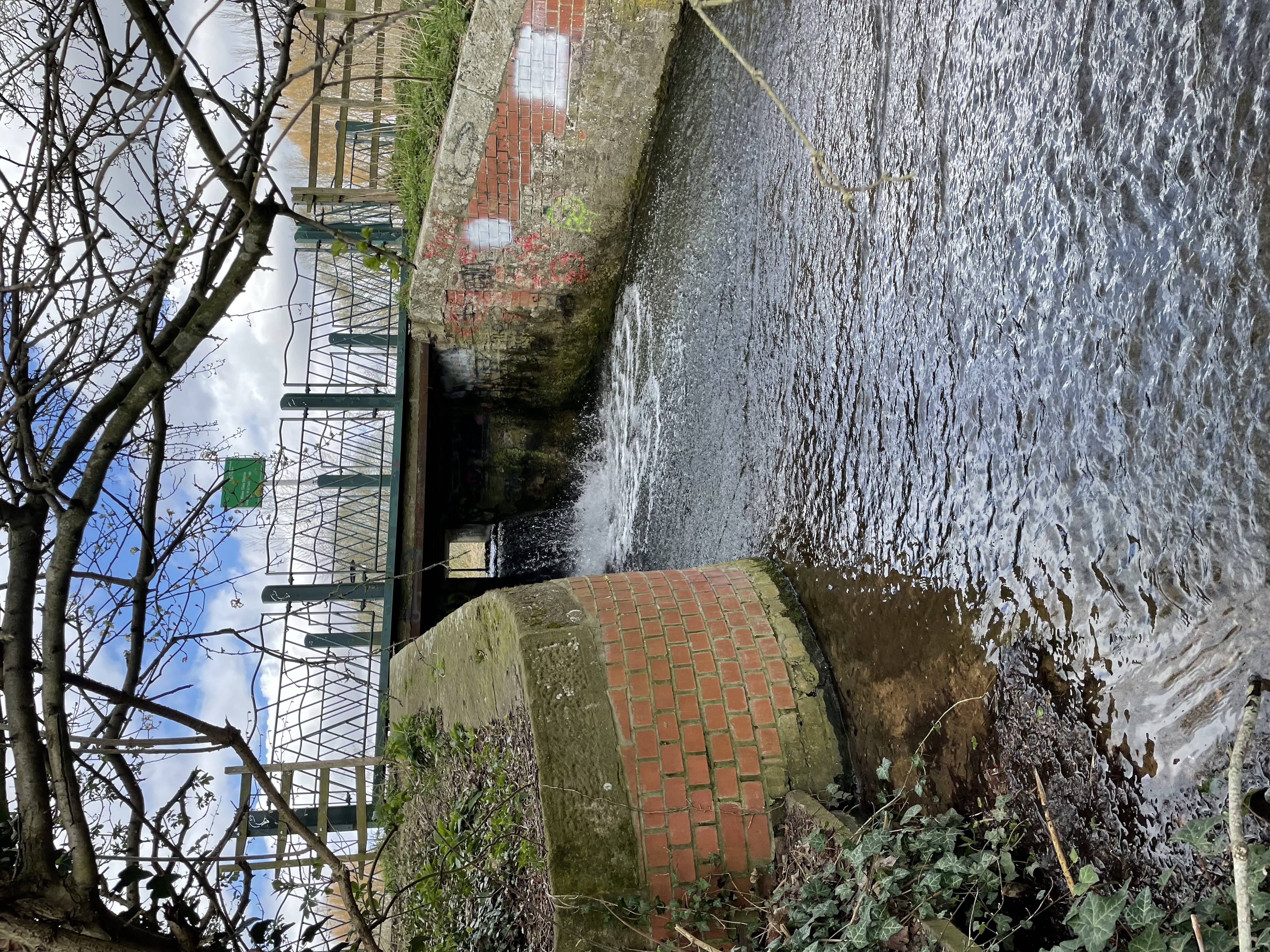
Throughout Sleaford there are several structures, including sluices, tilting gates, and weirs, which maintain water level for aesthetic and environmental reasons. However, these structures also interfere with natural river processes, prevent fish and eel migration and increase flood risk. When water levels and flows are high, the structures need to be altered to allow water to flow through to reduce flood risk. The river can also suffer from low flows as it is heavily influenced by groundwater, which is currently abstracted from to supply drinking water. This means the riverbed can be dry in some months. The structures are coming to the end of their design lives and are also costly to maintain and operate, and therefore require significant investment.
This project will assess the current structures and develop a package of options that aim to achieve a flood and drought resilient watercourse. By working with the community and key stakeholders, we will develop creative and sustainable solutions which benefit both the environment and the community.
Tell Us!
We recognise the importance of our stakeholders being informed and involved in the project and we value your feedback and local knowledge to help make the project a success. You can contact us at our dedicated email address: Riverslea.Floodresilience@environment-agency.gov.uk
Stakeholder survey coming soon...
You can download our latest stakeholder newsletter here: May 2024 Newsletter.
You can download our previous newsletters here:
To be added to our mailing list email us at Riverslea.Floodresilience@environment-agency.gov.uk
Where is the project area?
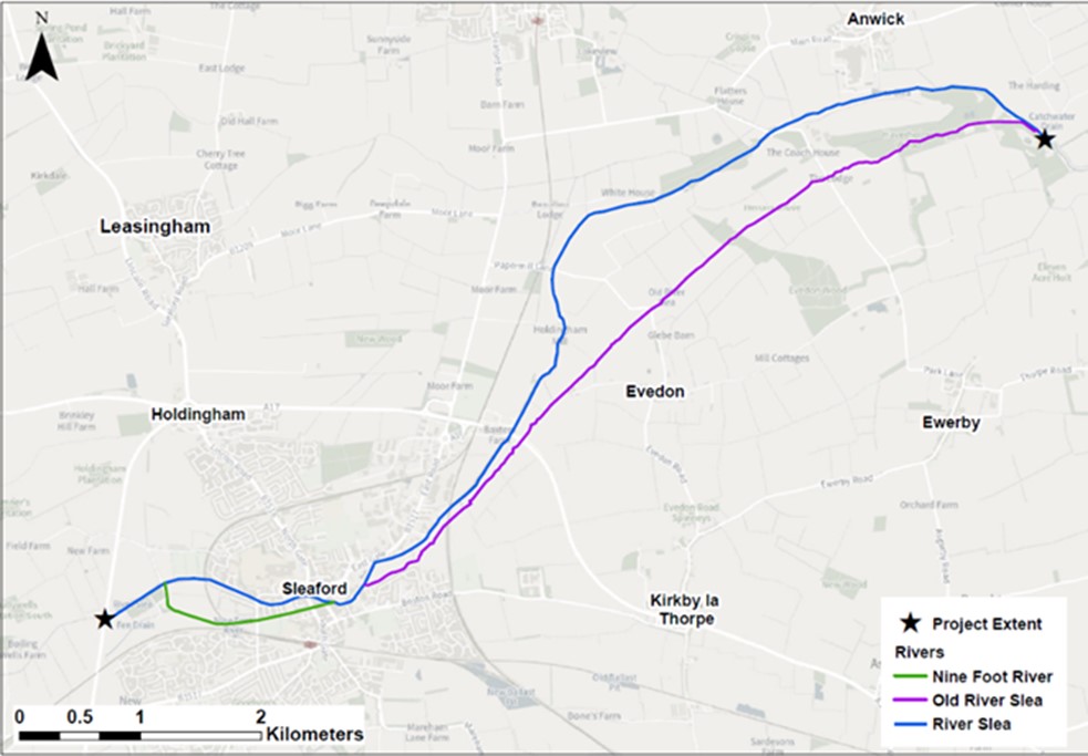
The project area stretches from the A15 to the west of Sleaford, to Cobblers Lock southeast of Anwick. The project also covers the Old River Slea and Nine Foot River.
What are the project objectives?
The project team have worked together to develop 6 key objectives. Click each of the objectives below to read more about them:
More Information
More Information
More Information
More Information
More Information
More Information
Project timeline
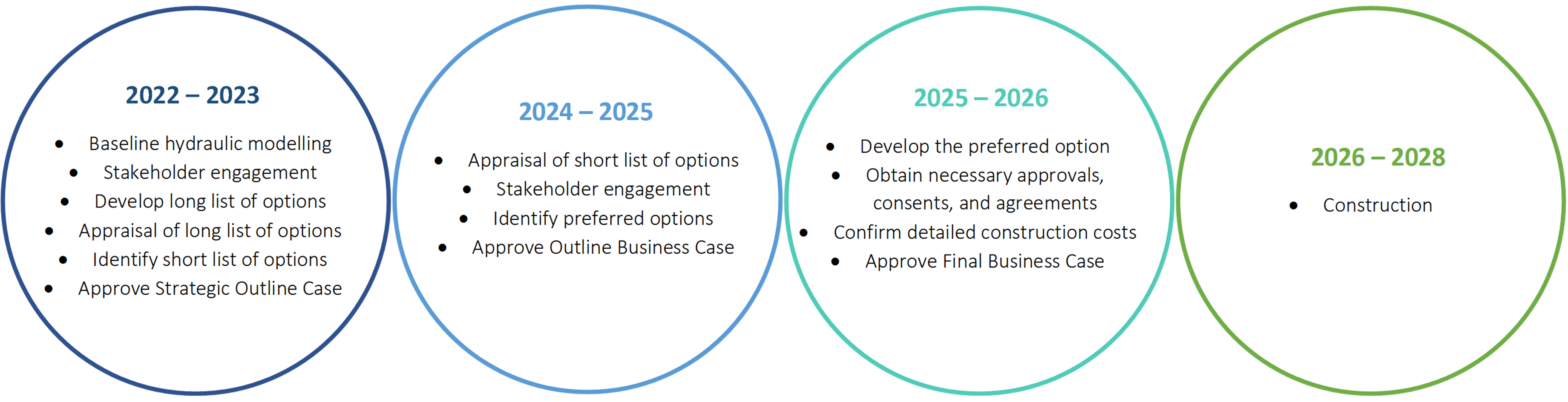
We have begun to identify options and are now working to reduce this to a short list of options to take to appraisal. Over 2023 and 2024 we will select which options we will take forward and move into the design phase of the project. We currently expect the construction phase to take place after 2025, but this is subject to change.
How are we engaging with our stakeholders?
From the outset, we plan to provide the opportunity for all stakeholders to express their views on the future plans to manage flood risk on the River Slea.
Upcoming engagement
As the project progresses, we will continue to engage with our stakeholders and the public, to provide updates on the short list of options and the preferred option.
This page will be updated with news of any upcoming engagement activities and events.
Previous engagement
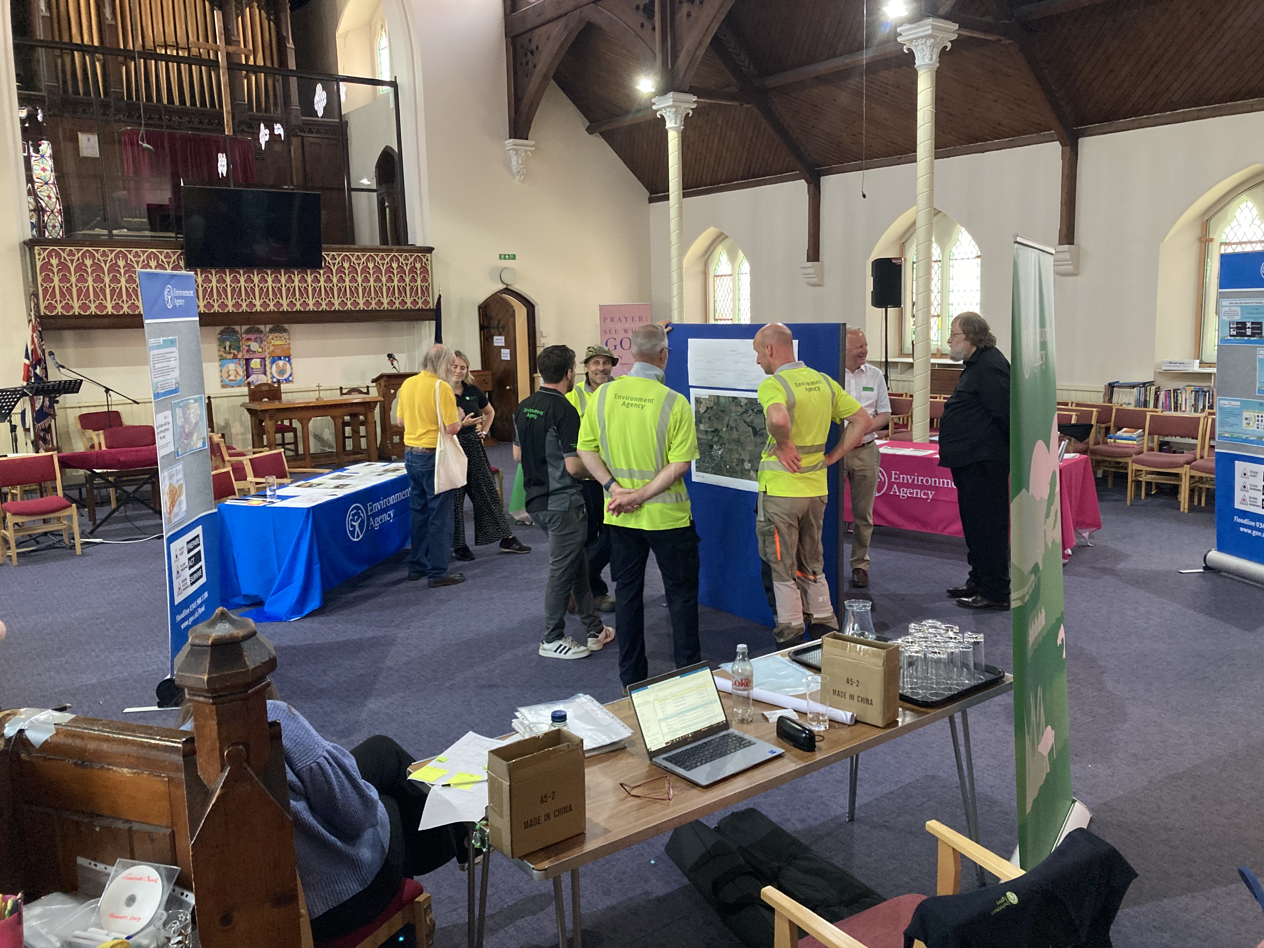
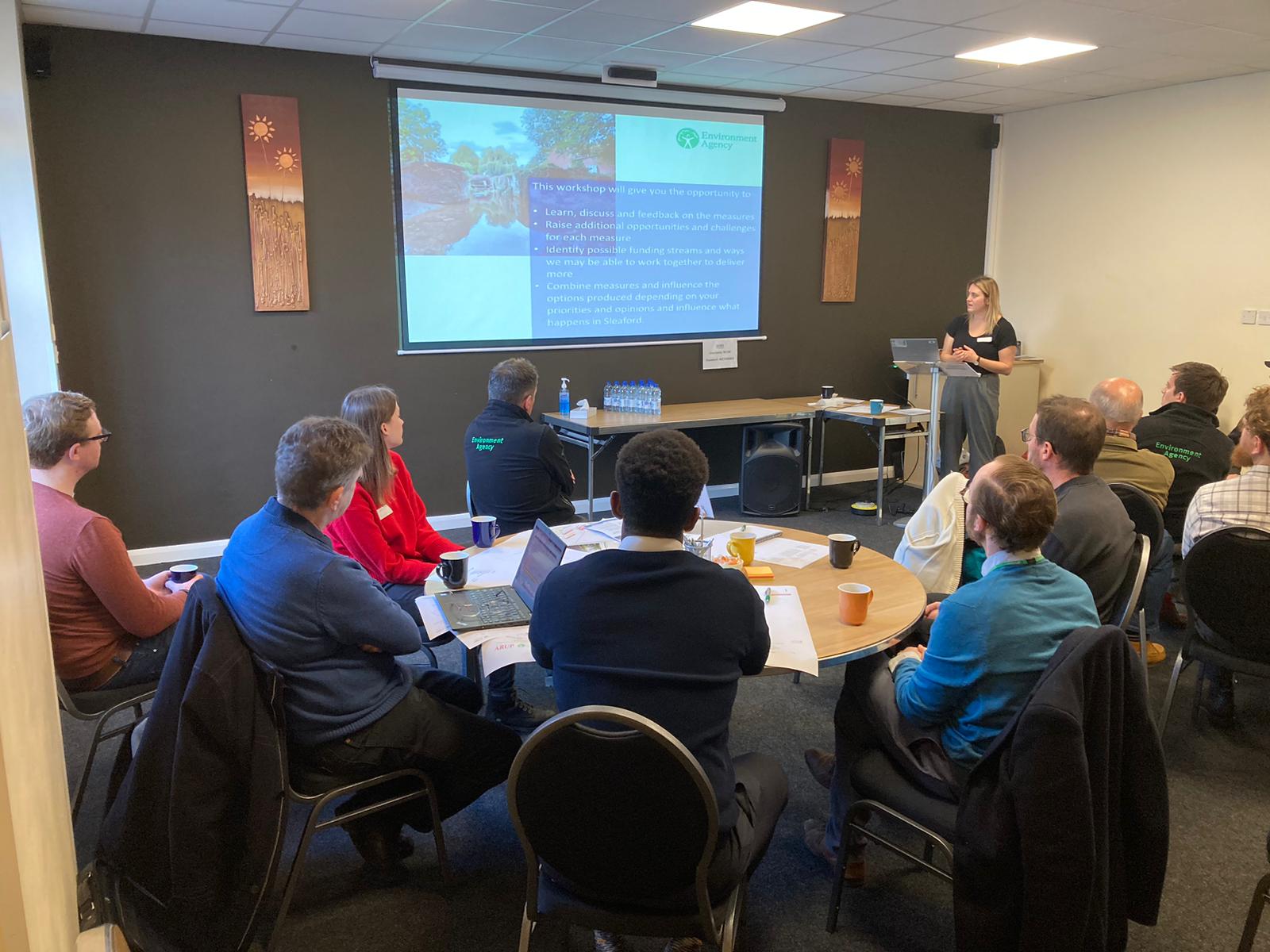
Towards the end of 2022 we held two workshops, where we invited ward councillors and key strategic stakeholders to learn more about the project and share their views and opinions on emerging ideas.
In June 2023, we held two community drop-in events, and in October 2023 we attended the RiverLight Festival in Sleaford. These events provided an opportunity for members of the local community to find out about the project, the operation and maintenance of river structures, and flood risk in and around Sleaford. We were also able to learn more about local views and aspirations for the Slea.
As the project progresses, we will be providing further opportunities for the wider community to learn more about the project and share your ideas and aspirations with us.
There are many ways you can keep up to date with the project, this website will be kept up to date with regular project updates and our next steps. We also have a project newsletter published in line with key project milestones, if you would like to be added to the newsletter mailing list, please let us know by emailing us via the project email (Riverslea.Floodresilience@environment-agency.gov.uk).
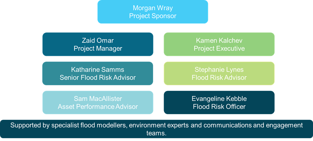
Who is involved in the project?
Click here to see who is involved in the project
The Environment Agency in partnership with Arup are exploring creative, economical, and sustainable options to reduce flood risk and improve the flow of the River Slea. The partners are dedicated to involving stakeholders throughout every stage of the project, from options development to post construction. There will be ample opportunity for stakeholders to contribute to the project and shape their community.
How will the project be funded?
Click here to see how the project will be funded
Flood risk management projects are funded according to a 'partnership funding approach'. This approach allows any worthwhile project (where benefits are greater than costs) to qualify for government money, known as grant-in-aid (GiA). The success of this approach depends on:
- Creating strong partnerships
- Clearly defining roles for responsible organisations and their partners
- Securing and managing contributions to help reduce flood and coastal erosion risks and achieve more benefits for the economy, local people and the environment
Where possible, we will also be looking to source funding from project partners.
Photo gallery
Click here for the photo gallery
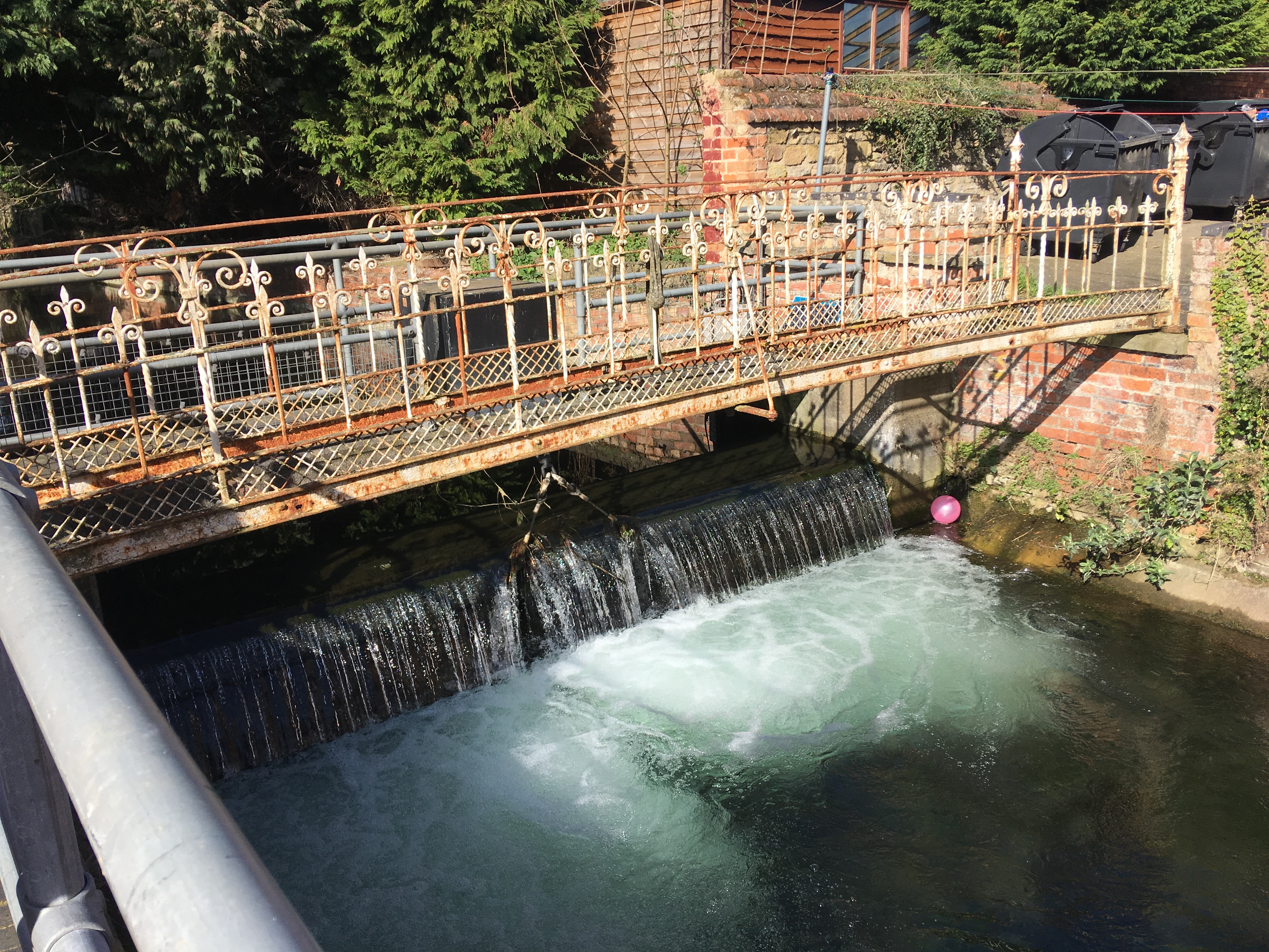
Carre Street Tilting Gate
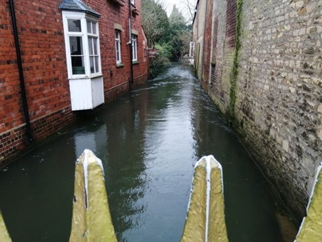
Nine Foot River from South Gate
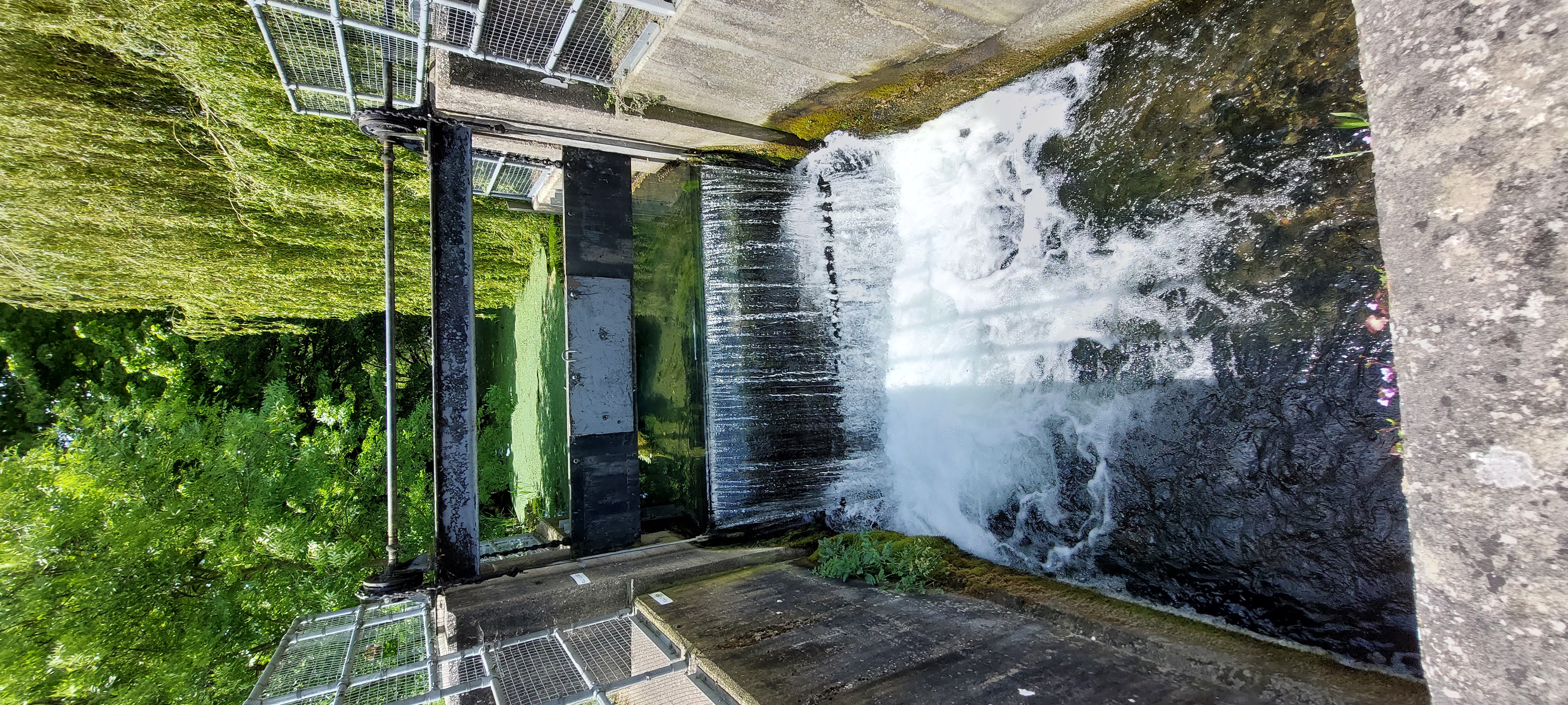
Cogglesford Mill Tilting Gate
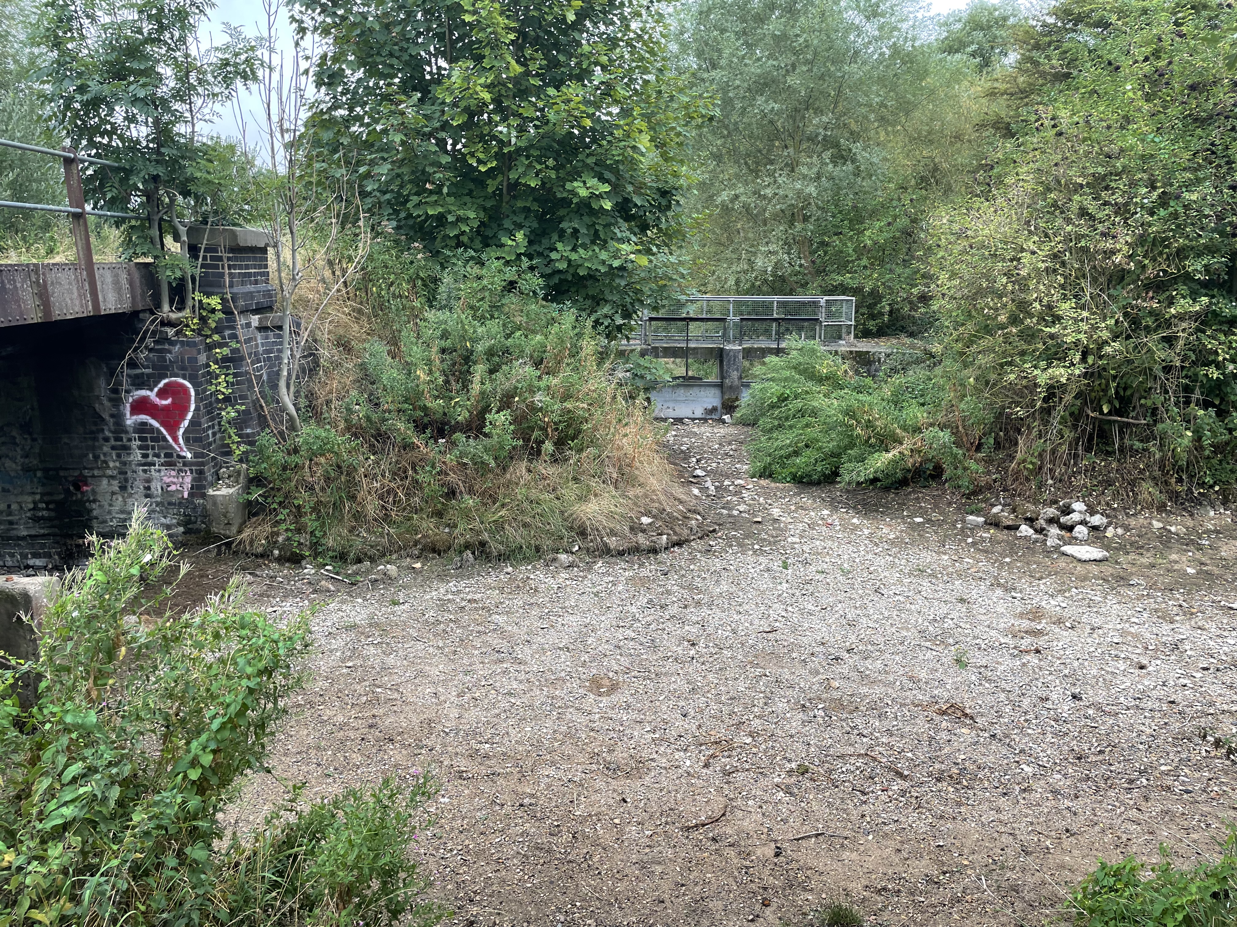
Dry riverbed of the River Slea
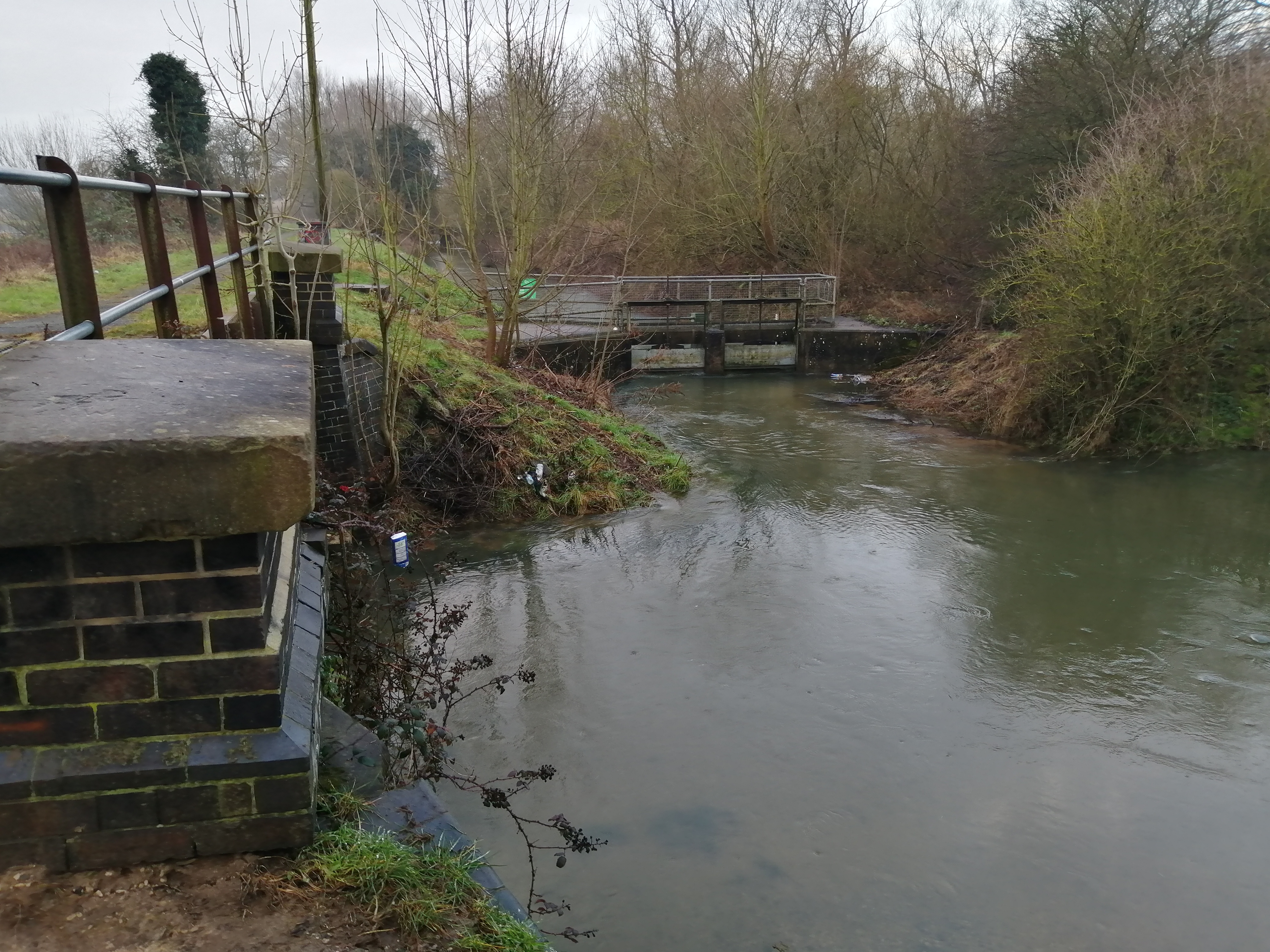
High flows at Cranwell Line Sluice
Swimming Bath Sluice
June 2023 Public Drop in Event
December 2022 Stakeholder Workshop
Audiences
- Community groups
- District and parish councils
- Drainage associations
- Elected representatives, including MPs
- Environmental bodies
- Farming associations
- Flood action groups
- IDBs
- Land owners
- Local authorities
- Members of the public
- Recreational and commercial river users
- RFCCs
- Water companies
Interests
- Business and industry
- Drought
- Fishing and boating
- Flood management
- Habitats and wildlife
- Specific projects, issues, or activity pages
- Water quality
- Water resources
Share
Share on Twitter Share on Facebook