Lydd Ranges Sea Defences Scheme - Why do we need the scheme?
Overview
The Lydd Ranges frontage extends from Jury’s Gap near Camber in East Sussex and extends eastwards for approximately 8.2km to Dungeness nuclear power station, Kent. The Folkestone to Cliff End Strategy (FoCES) reports 600 properties at risk of flooding from a 0.5% AEP event by 2108. 30 properties would be immediately at-risk, post breach (failure) of the defences. The Lydd Ranges and infrastructure would also be at risk. The site is a premier live firing training facility for the Ministry of Defence (MoD), providing unique training for troops immediately prior to operational deployment.
The existing flood defences require urgent improvement. There are currently no formal flood management assets at Lydd – a historic clay embankment, locally known as the Green Wall, provides some protection from the sea. The Green Wall runs eastward from Jury’s Gap, merging into high beach levels approximately 500m short of the Denge Marsh Outfall. In front of the Green Wall lies open natural beach.
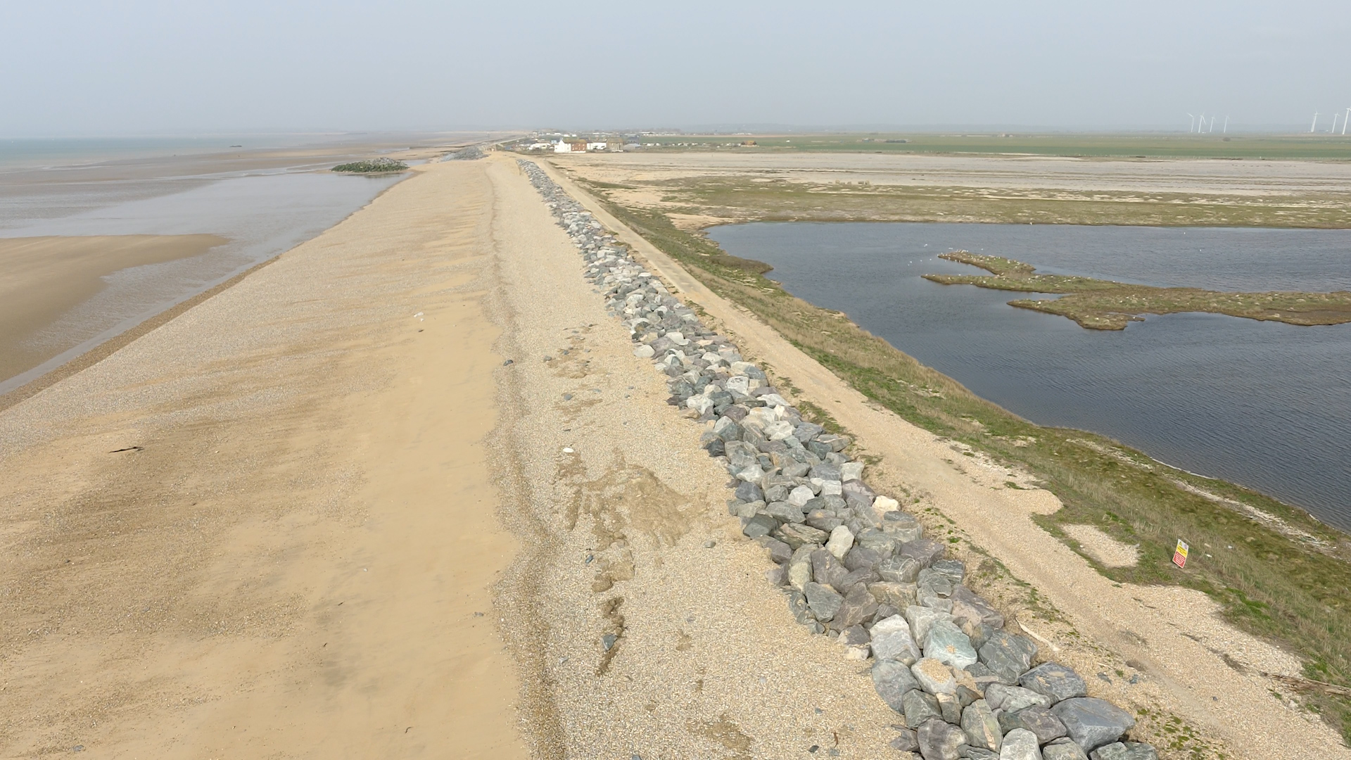
Progressive erosion of the beach has exposed the Green Wall to wave action, particularly over the western 400m. Emergency repairs have been necessary here during the last two winters to maintain a Standard of Protection (SoP) until the planned works can be constructed. These emergency works will be incorporated into, and form part of, the overall scheme.
The scheme is designed to address the following issues:
- Three failed groynes at Jury’s Gap on the western boundary frontage.
- The 400m section of the Green Wall immediately to the east of Jury’s Gap that is at greatest risk of breach. The defences are an integral part of the flood management to the whole Romney Marsh flood cell and currently present the weakest link.
- The beach is actively eroding and during storm events beach material is lost from immediately in front of the Green Wall requiring emergency shingle to be imported. If left to fail, the immediate area behind the defences will be open to flooding which would quickly spread into the marsh through the extensive land drainage network. On a number of occasions over recent winters, the protective beach has been stripped by storm action, exposing the clay core of the Green Wall to wave action and undermining the overlying concrete access track.
- The beach erosion rate averages 1.5m a year along the frontage, although the Green Wall and beach storm ridge diverge eastwards such that as the beach widens to the west it provides an increasing buffer to flooding.
To return to the homepage please click here.
Audiences
- Academics
- All water abstractors
- Angling trade contacts
- Businesses
- Charities
- Community groups
- Community groups
- District and parish councils
- Drainage associations
- Elected representatives, including MPs
- Elected representatives, including MPs
- Environment Agency colleagues
- Environment Agency customers
- Environmental bodies
- Farming associations
- Fishing clubs and representative associations
- Flood action groups
- Government family organisations
- IDBs
- Land owners
- Lead Local Flood Authorities
- Local authorities
- Local councils
- Local Risk Management Authorities
- Medium Combustion Plants
- Members of the public
- Members of the public
- Members of the public
- Members of the public with an interest in the river, the species and conservation
- Metal recycling trade associations and site operators
- National based fishery, conservation and landowner organisations
- Net fishing license holders
- NGOs
- Non-governmental organisations with an interest in environmental issues
- Operators
- Other regulators
- Recreational and commercial river users
- Recreational and commercial river users
- RFCCs
- Statutory organisations
- Trade associations and business
- Water companies
Interests
- Business and industry
- Coastal management
- Drought
- Fishing and boating
- Flood management
- Habitats and wildlife
- Specific projects, issues, or activity pages
- Water quality
- Water resources
Share
Share on Twitter Share on Facebook